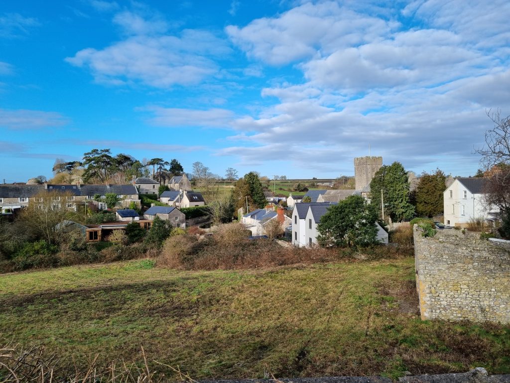
The main trench of the Cardiff University excavations at Llantwit Major is sited in the ‘Globe Field’, so-called because it was previously owned in conjunction with the former ‘The Globe’ pub.
The field lies just to the south of Llantwit Major church and is a remarkable survival of green space close to the heart of the village. In part, this survival is due to the development of the medieval town outside the earlier monastic site, so the whole town is asymmetrical with the church on its western edge.

The earliest surviving map that shows the field is the Tithe Map of c. 1840. The field was subdivided into three at this time – with the divisions running parallel to the drains discovered in the excavations.
The three subdivisions of the field, together with parcel 667, a house and garden now The Tudor Tavern in Church Street, were held by William Smith from Llewellin Price. Llewellin Price also owned parcel 669, with a house that included what are now Church Cottages, held by John Richards. The current name by which the field is known, ‘The Globe Field’, reflects this 19th century tenancy. That the property was not listed as an inn in the Tithe survey (the apportionment is dated 11th August 1840, the map to 1842), does not preclude it having been such and the 1841 census less than a year later (taken for the night of 6th June 1841) lists the occupation of William Smith as publican at a point in the list compatible with the location of the Globe Inn, even if it is not named.
Llewelin Price appears to have been born 7/10/1750 in St Lythans. According to genealogical accounts, his first wife, Mary Jenkins, died in 1778 and he remarried to a Catherine Philip of St Lythans. Mathew, born c. 1793 is believed to be their first son. In 1784 Llewelyn was a carpenter with an apprentice. Catherine died in c.1802 and Llewelyn married for a third time to Susannah Butler in 1803 (at least according to genealogical websites – this supposed marriage may be a case of mistaken identity). More certainly, Llewelyn Price, widower, married Catherine John of Llancarfan, his last wife on 10/7/1813. During the 1820s a Llewelyn Price of Llancarfan appears on voting lists for the County and most entries in the Llancarfan Parish marriage register for the period March 1813- July 1838 have Llewelyn Price as a witness. ‘ Lewelyn Price’, clerk of Llancarfan church, aged 88, was recorded as being buried on 22/11/1838. This means that the Tithe survey was relying on slightly out-of-date information! His widow, Catherine, was given in the 1841 census as 60 and of independent means, the 1851 census as a 77 year old pauper (Carpenter’s widow) and as aged 86 in the 1861 census.
The electoral registers of 1845, 1846 and 1853 list Mathew Price of Welsh St Donats as owner of the Globe Inn. This Mathew Price can be identified with the Mathew Price, carpenter, of Llantrithyd who married Gwenllian Thomas 29/07/1820 at Welsh St Donats and with the first son of Llewelyn Price. Gwenllian appears to have been born at Llancarfan in c.1799. the 1841 census lists the family as: Mathew Price 40, Carpenter, Gwenllian 35, James 20 Carpenter, Christopher 15 Carpenter, Thomas 15 Carpenter, Edward 13, Margaret 11, Elizabeth 8, Ann and by 1851 there was a further daughter, Catherine, but Mathew is not listed, and Gwenllian is given as head of the household.
Mathew Price’s family appears to have lived at Heol y March. Welsh St Donats for the rest of the century. Mathew and Gwenllian’s first son, James, was born 1821 and he was still at the same place aged 80 in the census of 1901. Mathew d 1881 and was buried 7/4/81 at Welsh St Donats aged 82; Gwenllian died in 1883, aged 84. The burial was recorded on 14/2/1839 of Llewelyn Price age 9 weeks, of Heol y March, Welsh St Donat’s, presumably named for his grandfather.
This local detail does not, unfortunately, shed any significant light on the nature of the pre-19th century holding of the Globe Field. How and when Llewelyn Price, carpenter of Llancarfan, acquired the property is not clear. No links directly between him and Llantwit have been identified. Of his four wives, Mary Jenkins and Catherine Philip were both from St Lythans (as was he), Susannah Butler (if a wife of this Llewelyn at all) was from Wiltshire and Catherine John was from Llancarfan.
One possible clue might be in Catherine John’s surname – for the holding south of the Globe Field was labelled as ‘Cicil John’s land’ on the 1766 Plymouth estate plan. It is conceivable, although with no evidence, that Llewellin may have acquired the property from his last wife, but that on his death the property passed to his first son (by his second wife).

The history of the detailed topography of the field becomes easier to trace after the 1st Edition OS mapping of published in1877. By this time, the northern two parcels of 1840 appear to have been amalgamated and there is a small structure, probably a pig stye, near the entrance to the field. The southern parcel of land was a kitchen garden.
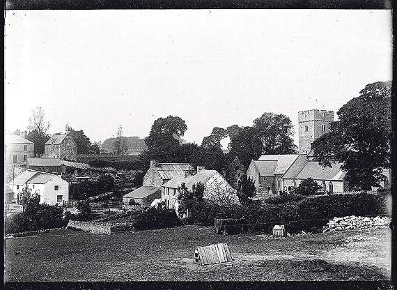
At some point in the late 19th century, a quarry was dug near the top (east) of the field. The debris of the abandoned quarry is shown on an undated photograph (but which appears to show the church after the renovation of the East church, so post-1904). The debris was subsequently tidied and photos of the period 1905-1910 show a tranquil pasture with chicken-coops.
Later, in the period before 1919, further buildings were added alongside the earlier pig stye, including the two-storey cart shed/hayloft that still survives (albeit as a ruin).
A vertical aerial photograph of 1945 (RAF 206 G UK f 3043, 26/09/1945) shows the same buildings along the NE edge of the Globe Field. The northern part of field is laid out in rectilinear plots, but not narrow E-W strips, with some isolated sheds. These plots (and those in the southern half of the field), look a little unkempt, but the wall between the two divisions of the field is still present.
During the 1950s the western part of the northern division was laid out in E-W strips, probably as part of a short-lived market gardening venture. Big changes came to the field in around 1960/62, with the dumping of rubble in the top of the field (over the site of the former quarry) to create an area of hardstanding, with rows of garages built along the NE and E sides of this and the abandonment of the market garden to the west.

The garages survived until at least 1998, but were removed progressively by 2006. The field has remained essentially untouched (apart from mowing and some grazing) since then.