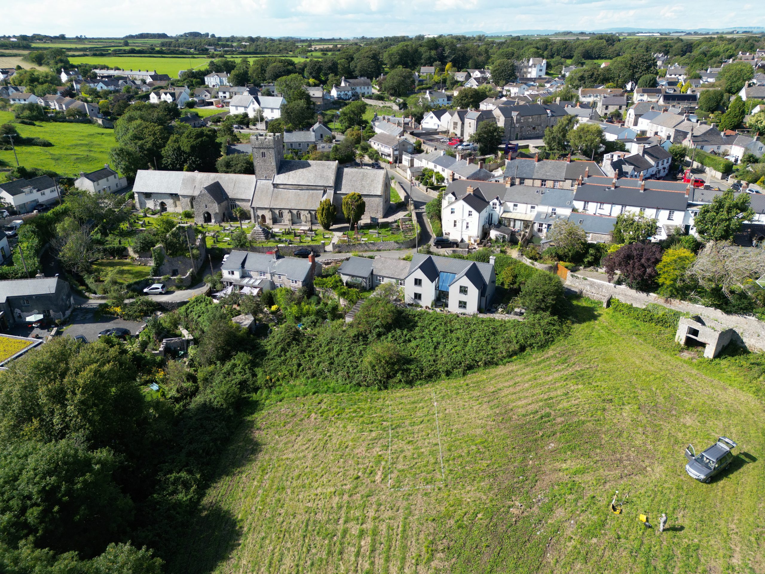
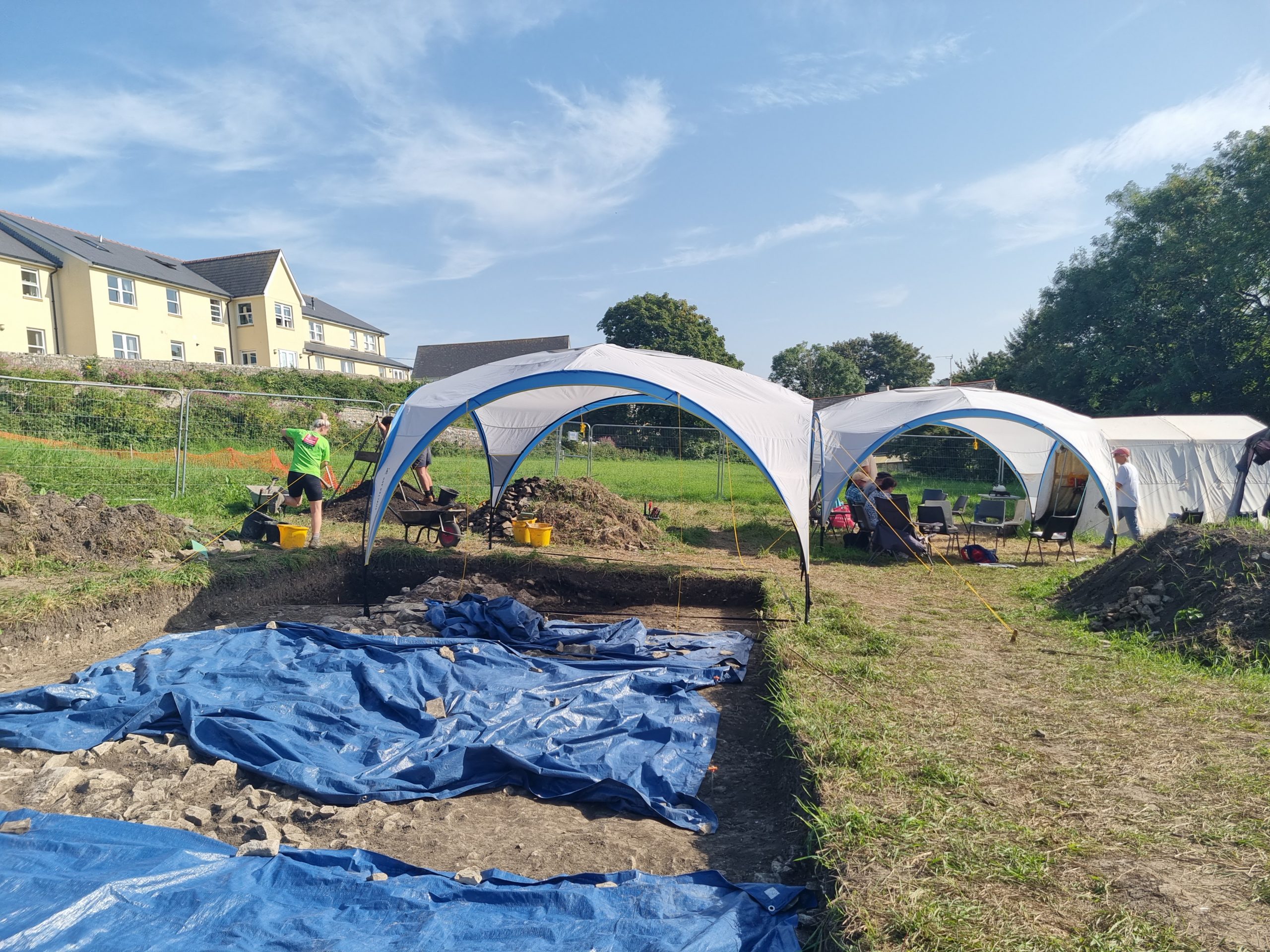
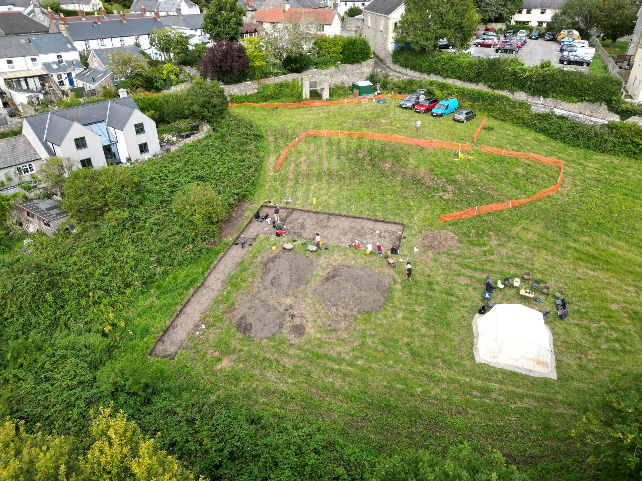
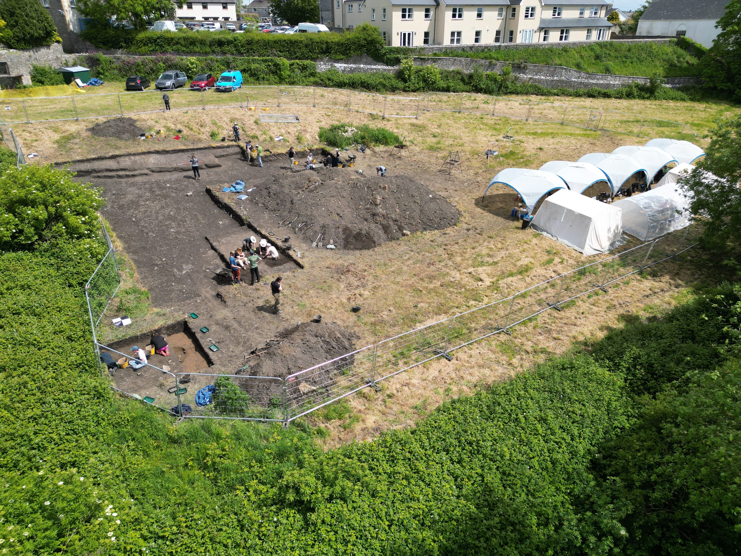
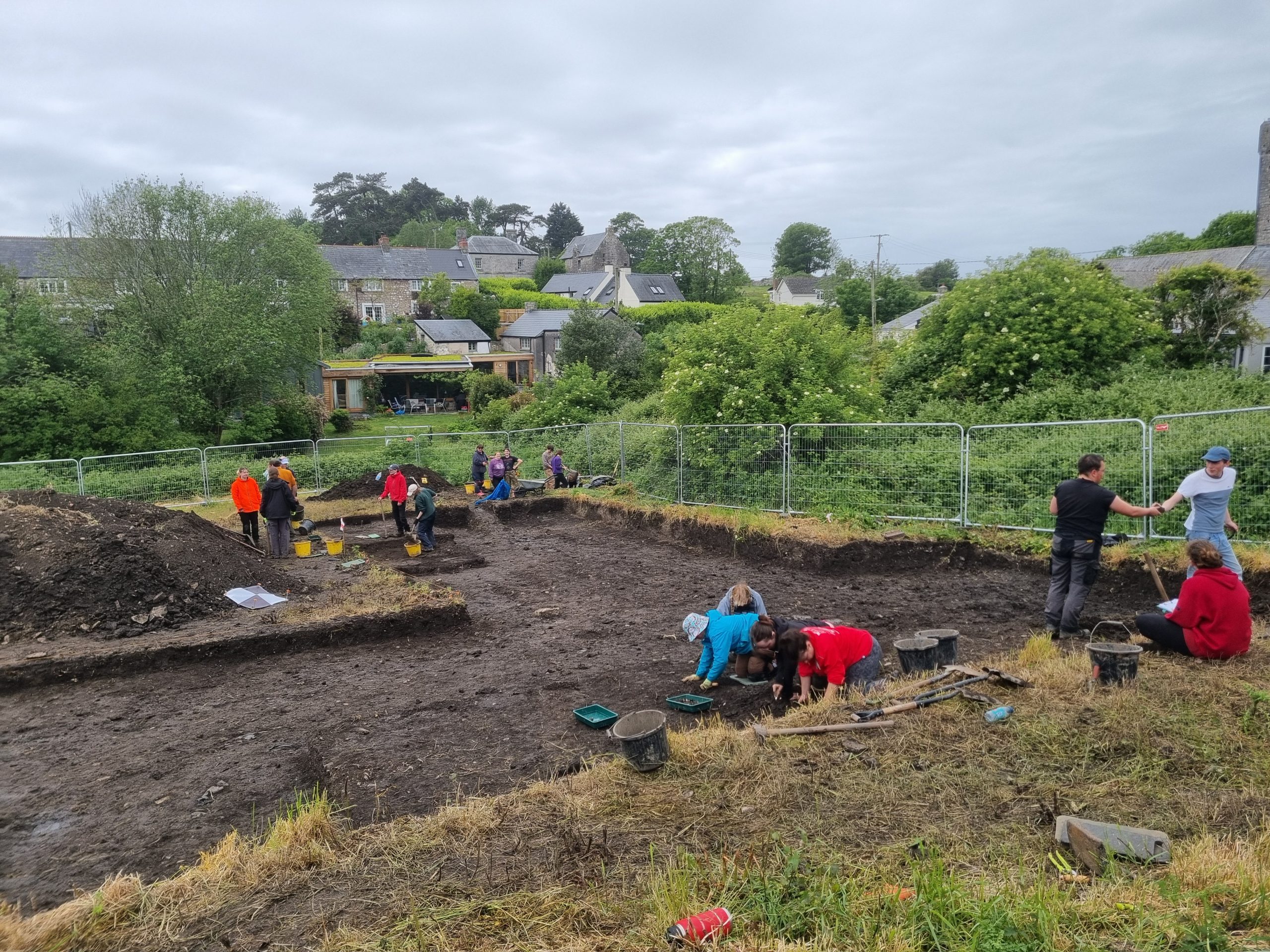
23/6/26: the weather has been hot for the last two days – a return to almost exactly the same temperatures are we had a month ago. After much rummaging and sorting, we salvaged enough parts from the shelters demolished by the strong winds a few weeks ago, to have three complete ones to take back out on site today. It has been only a small team of washers and diggers, but the shade was appreciated.
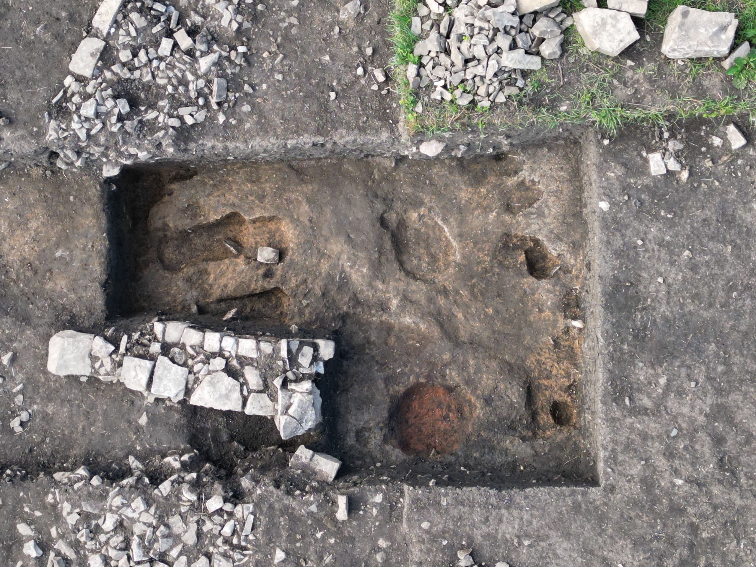
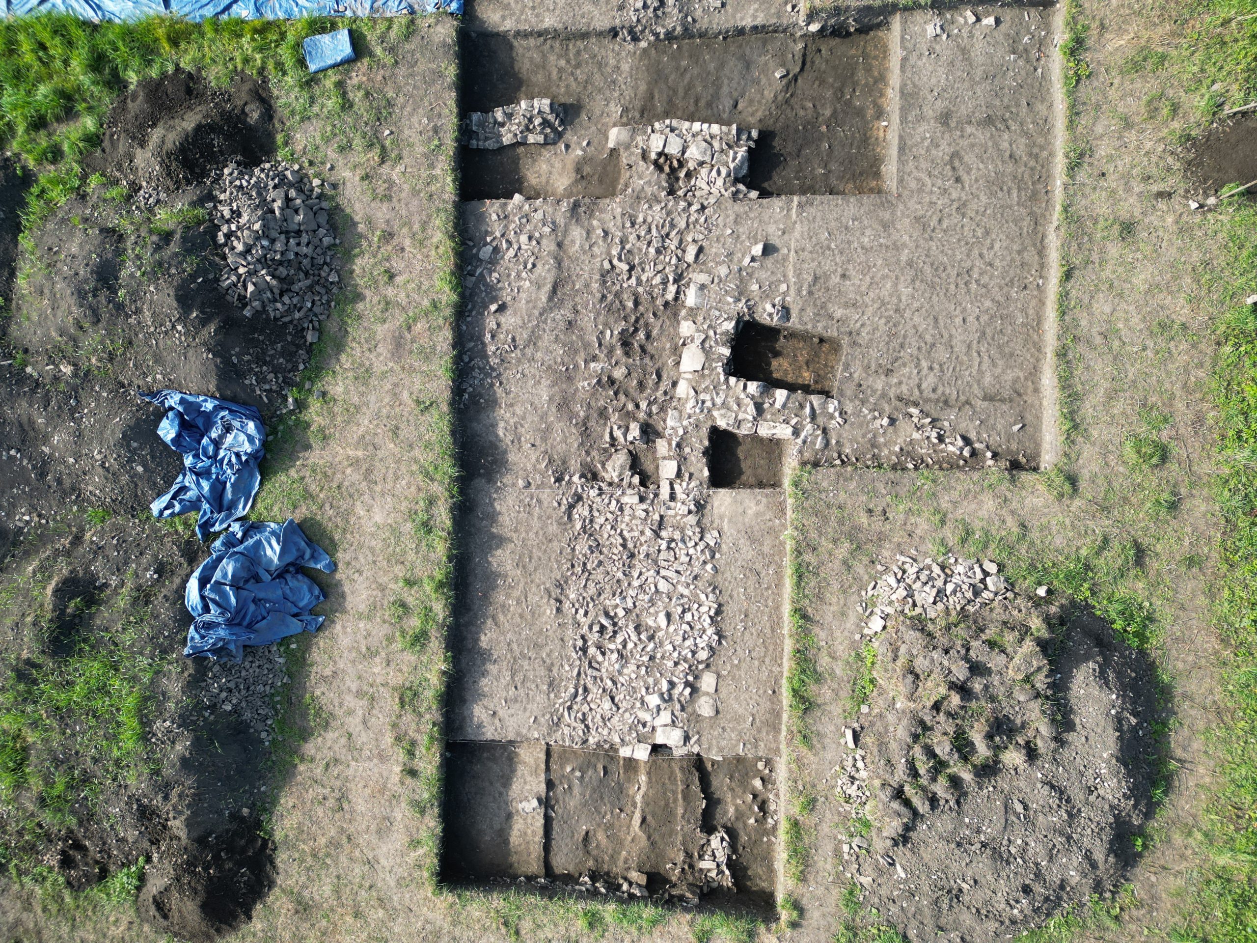
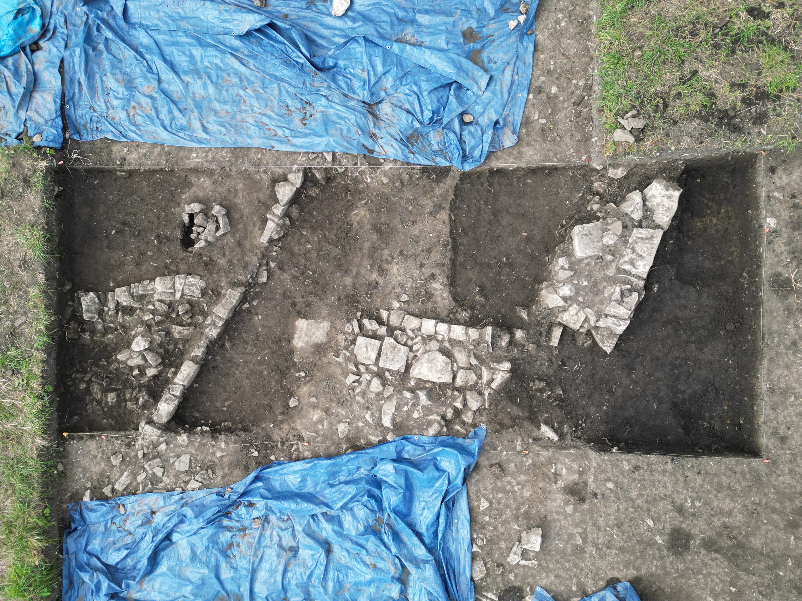
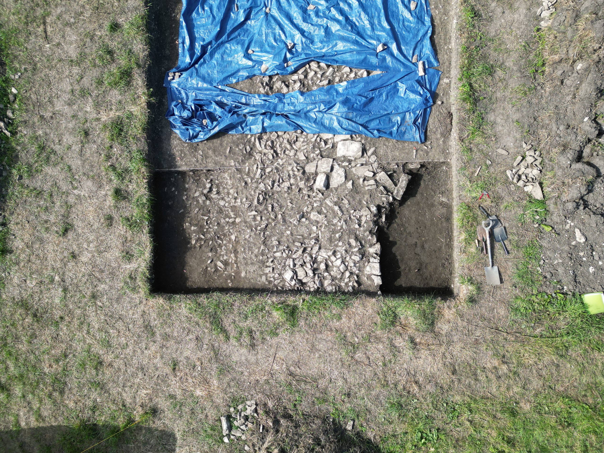
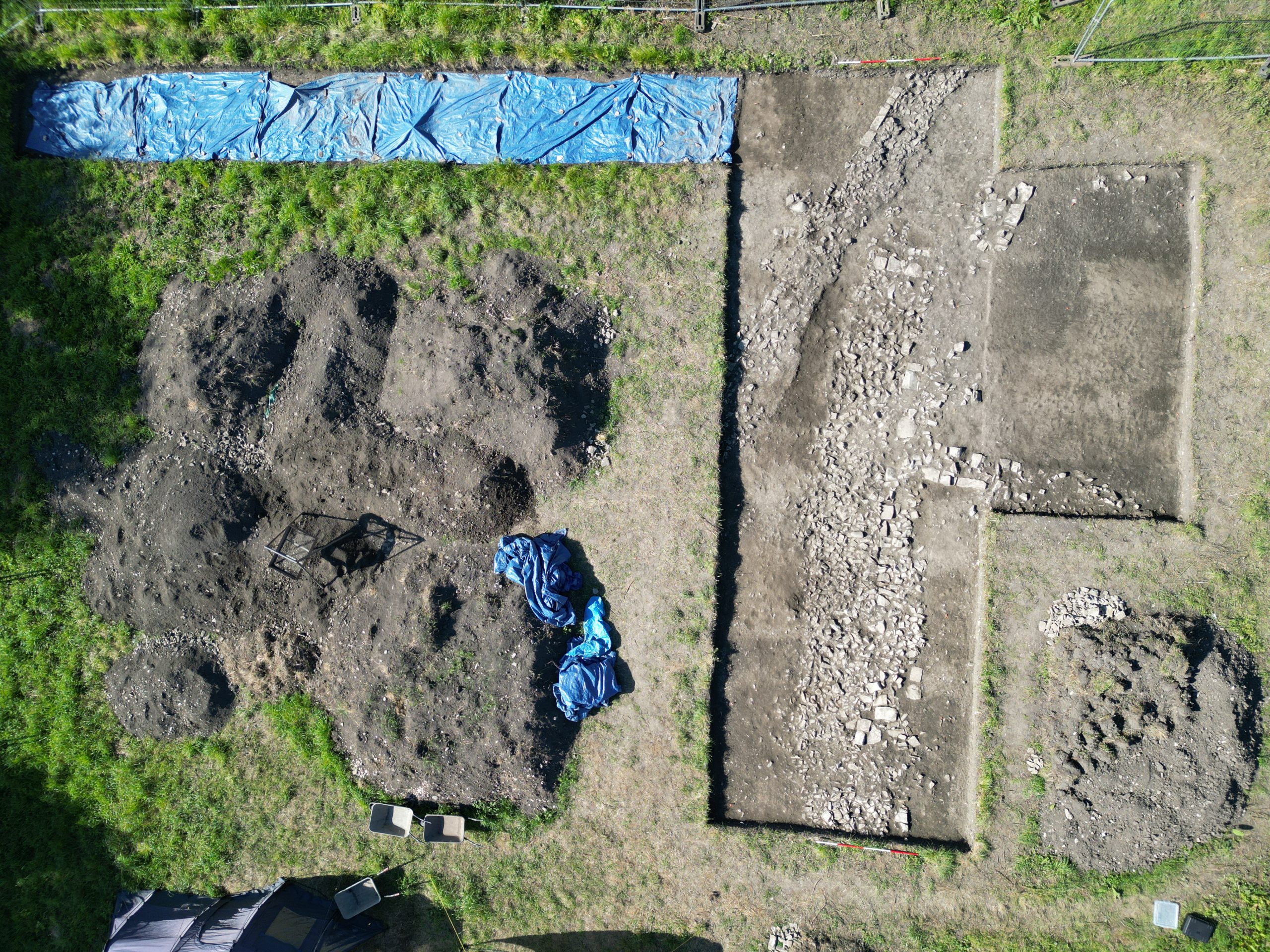
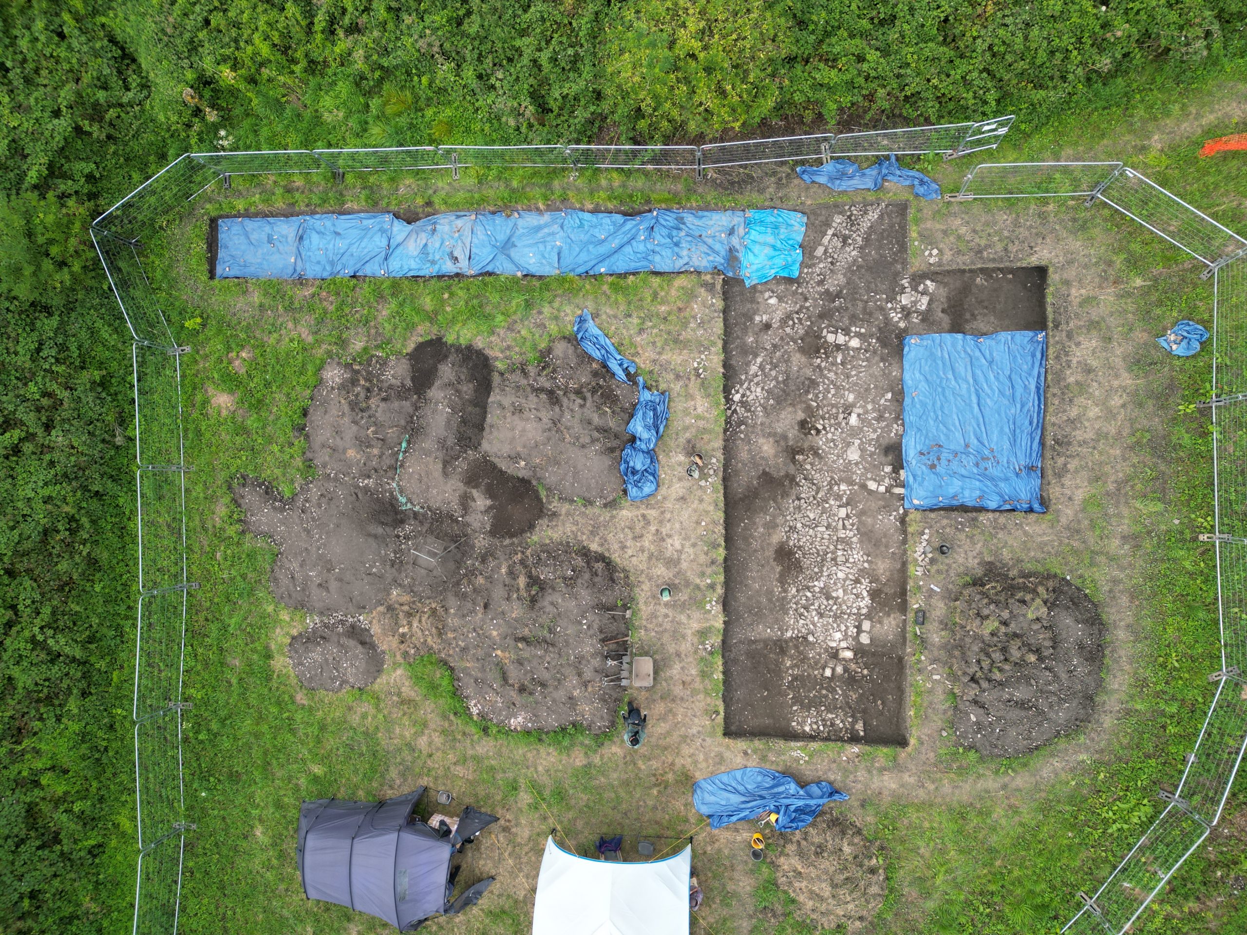
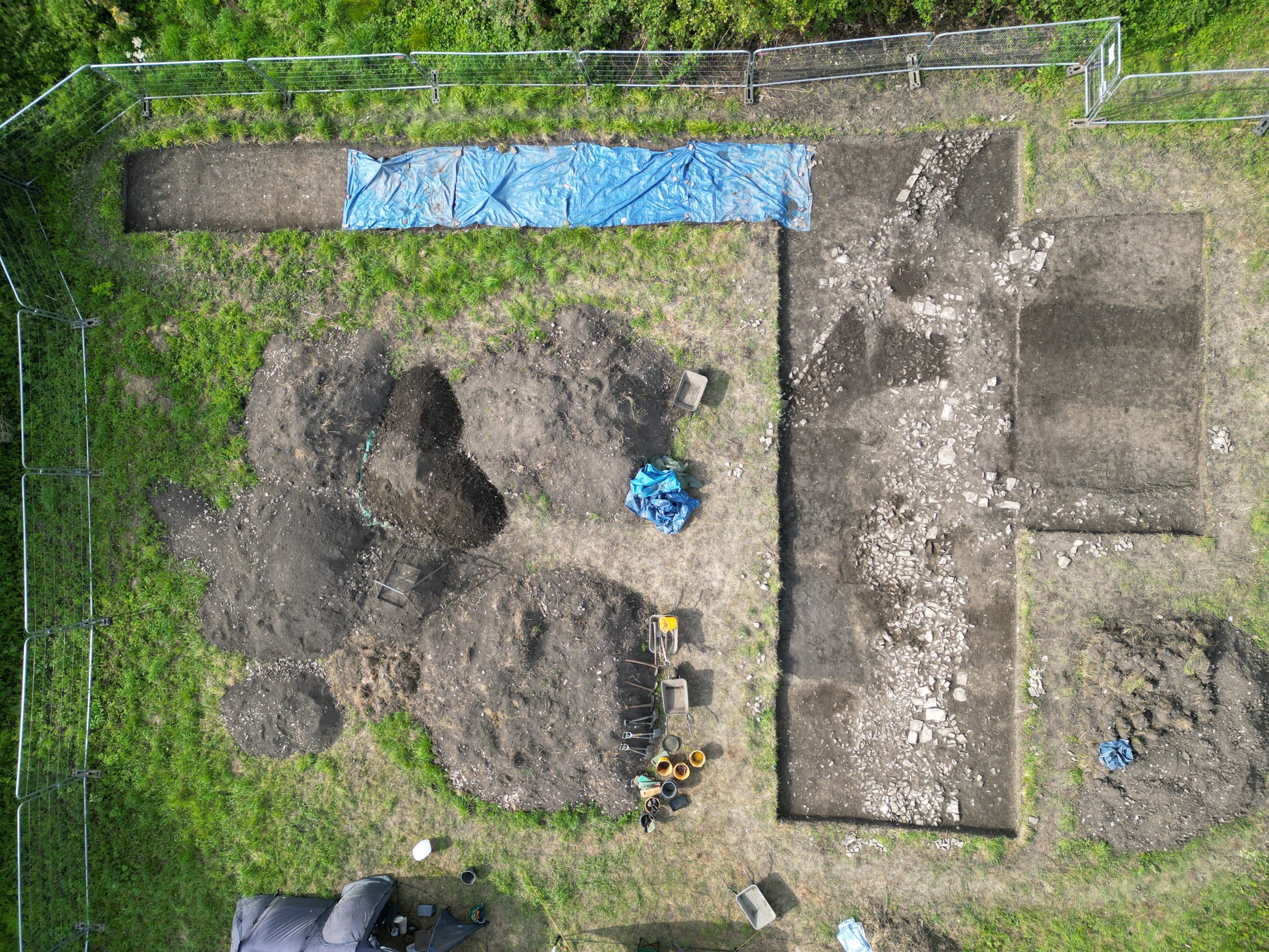
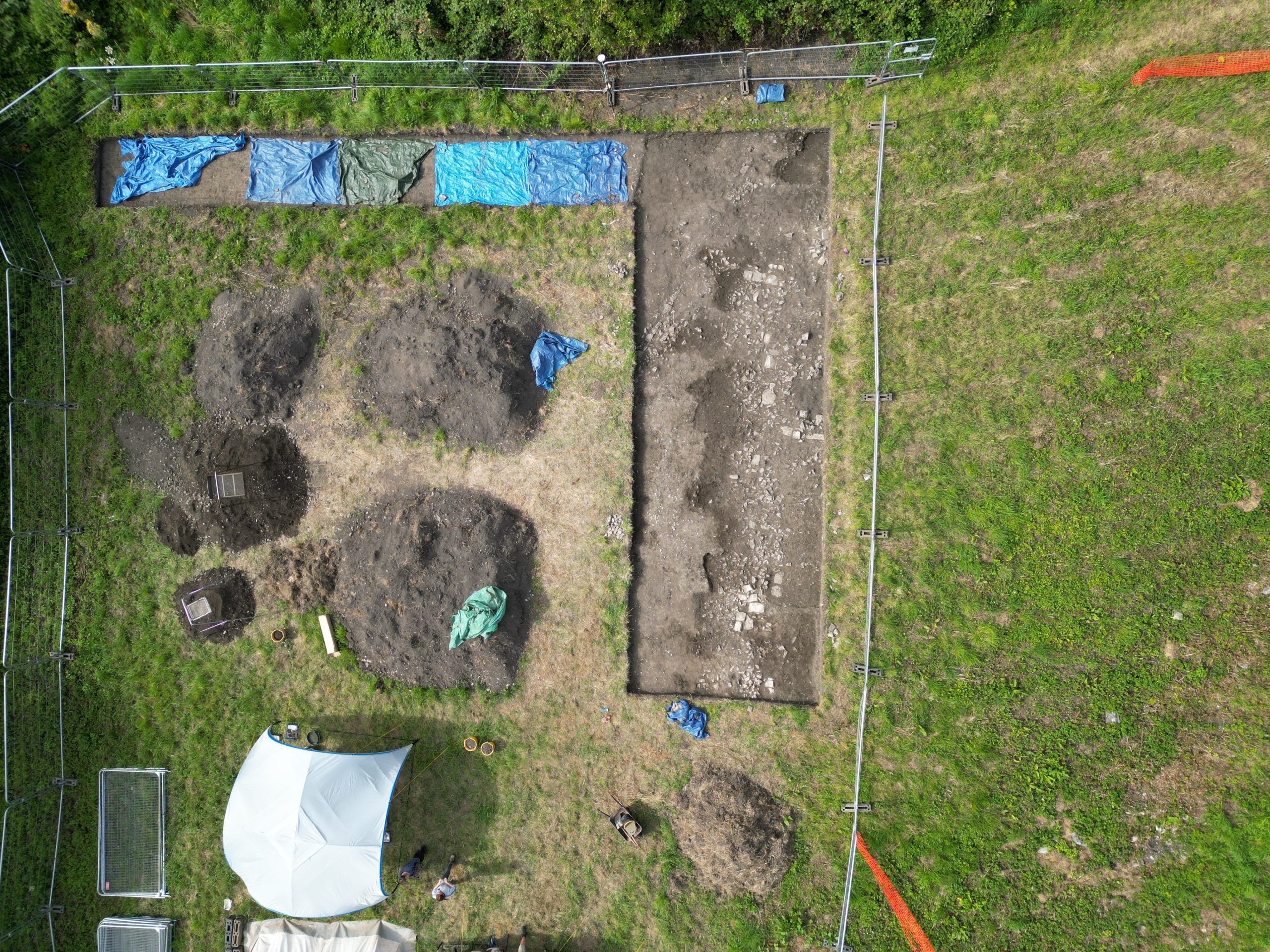
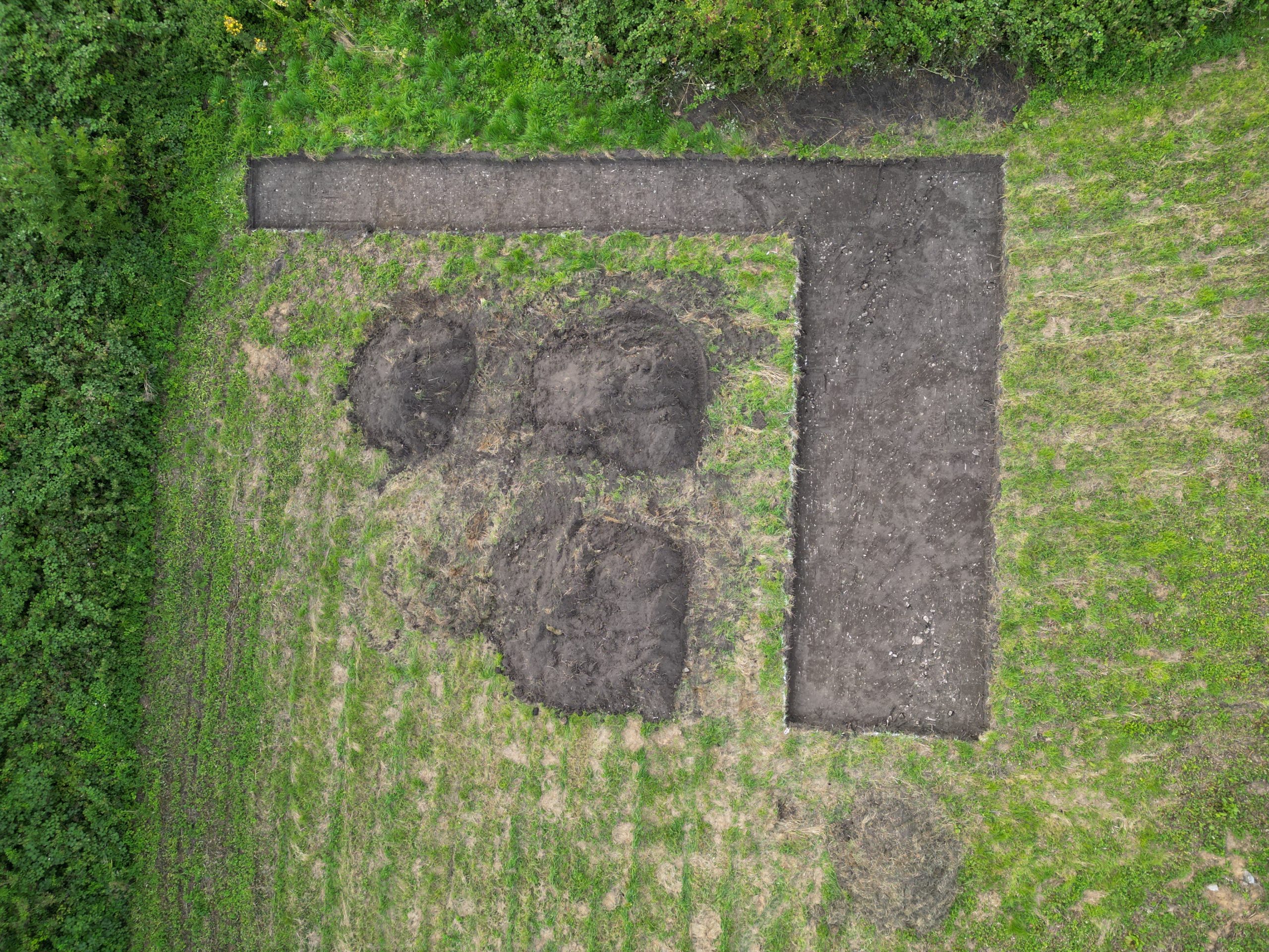
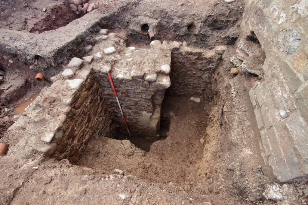
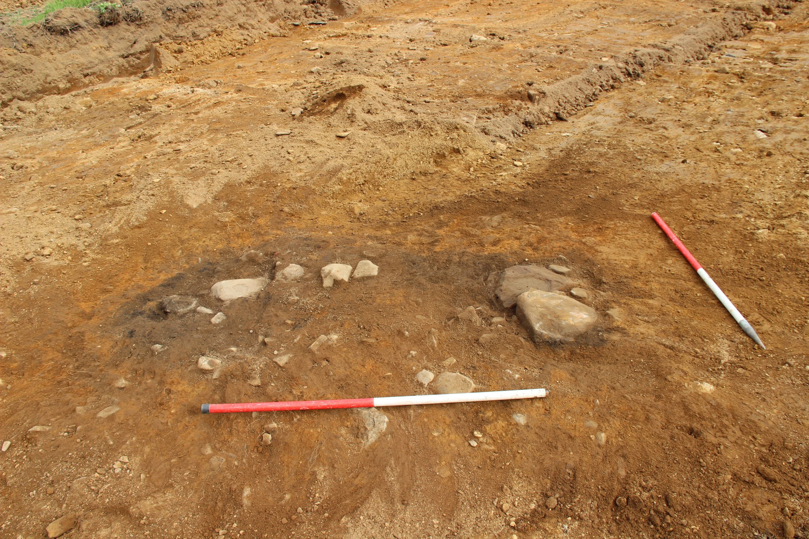
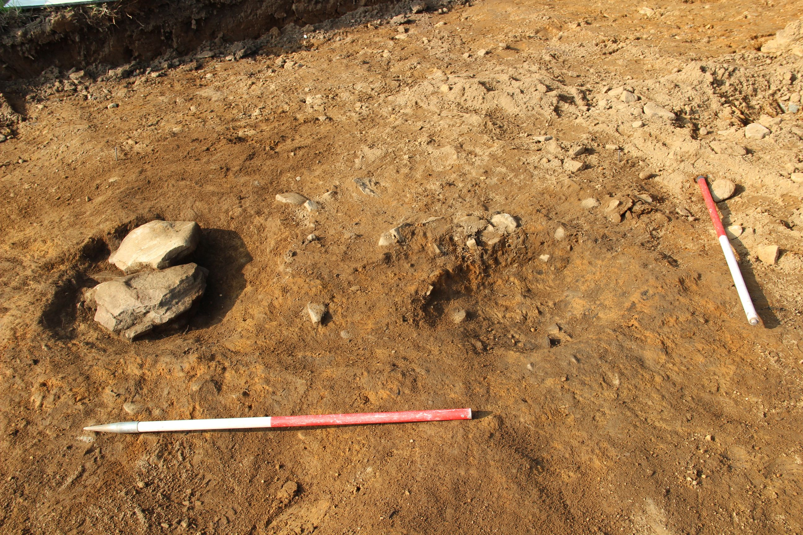
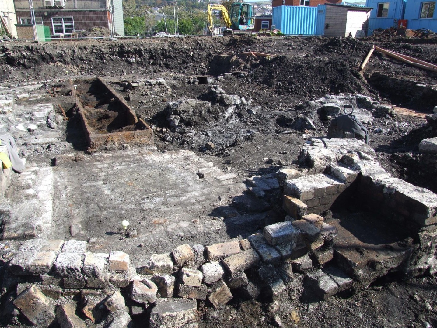
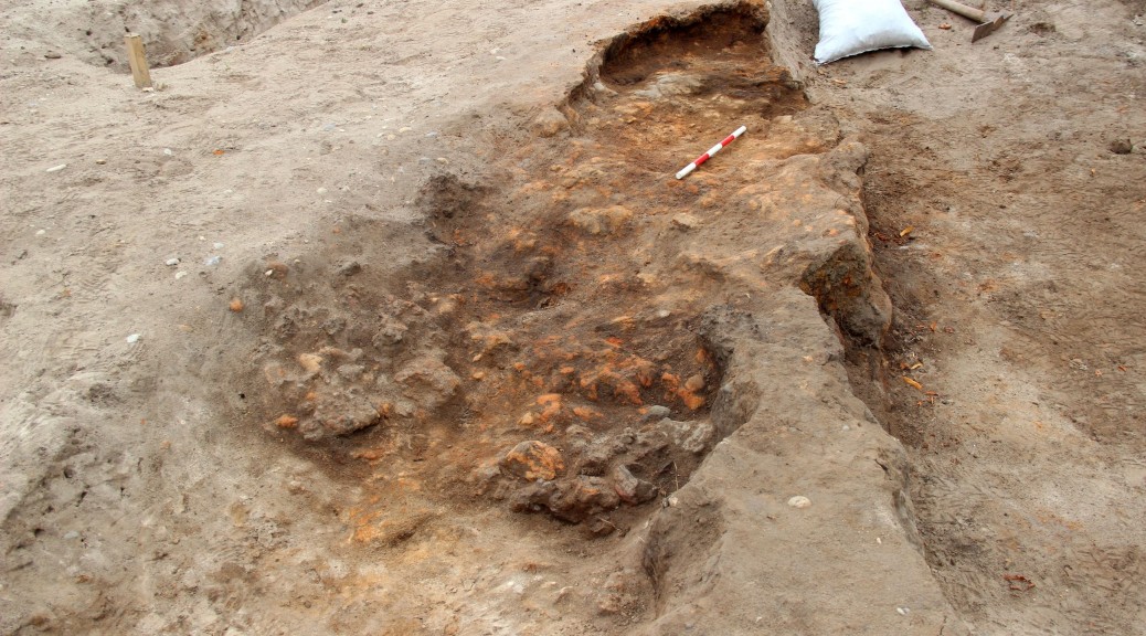
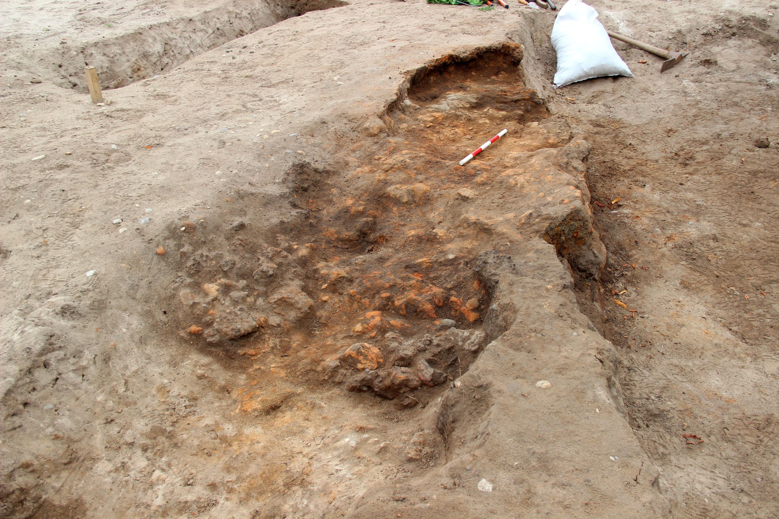
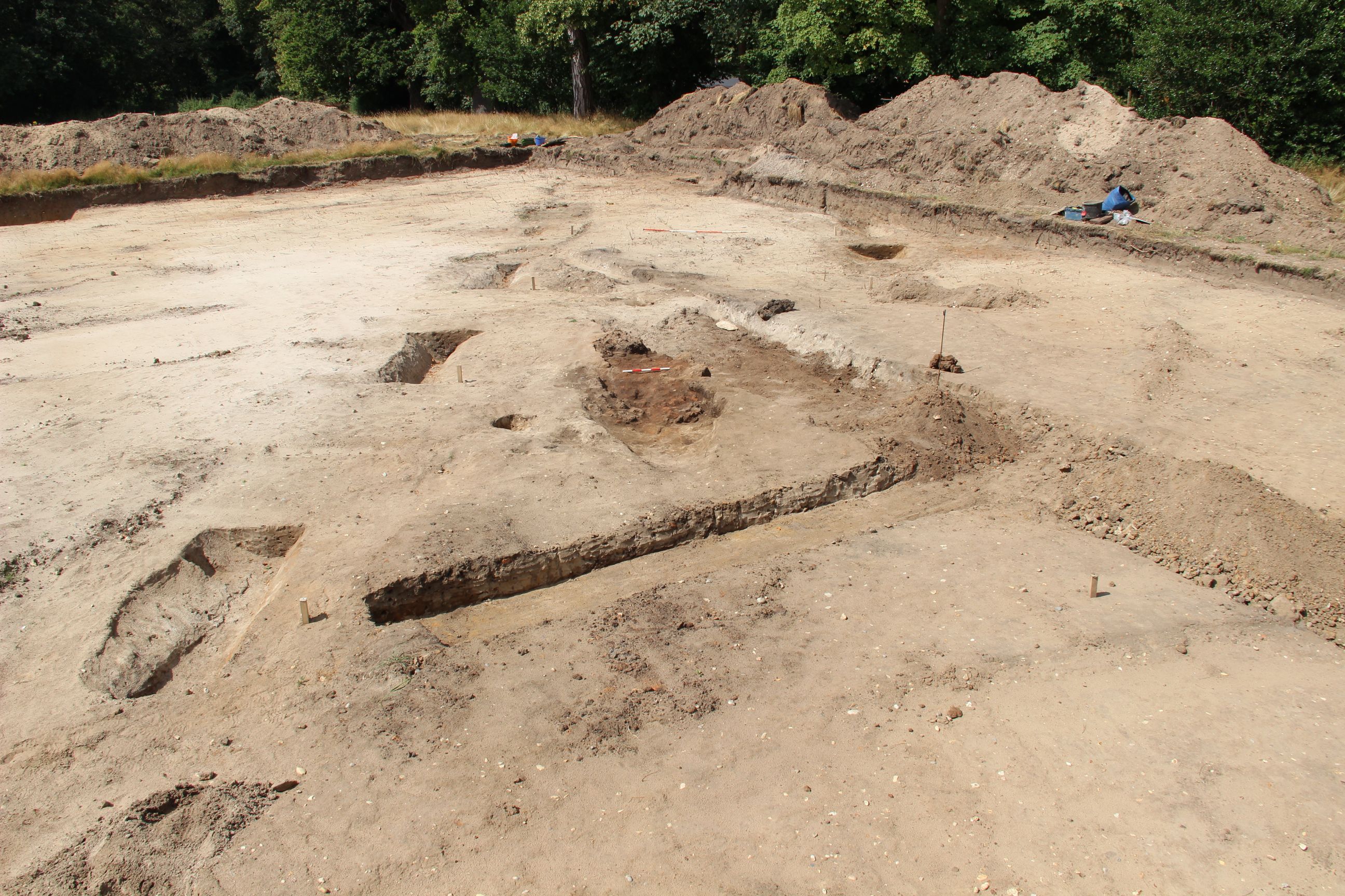
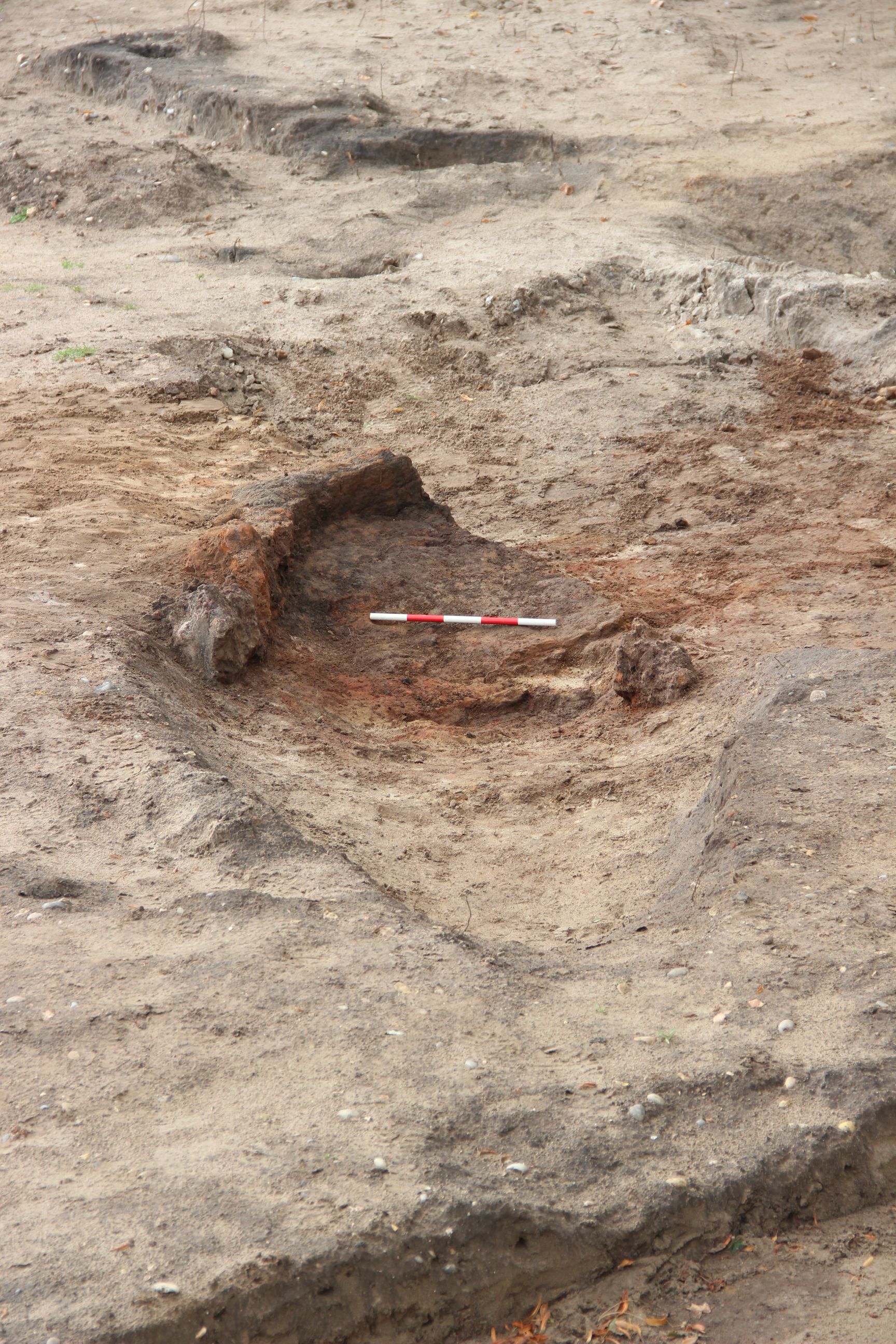
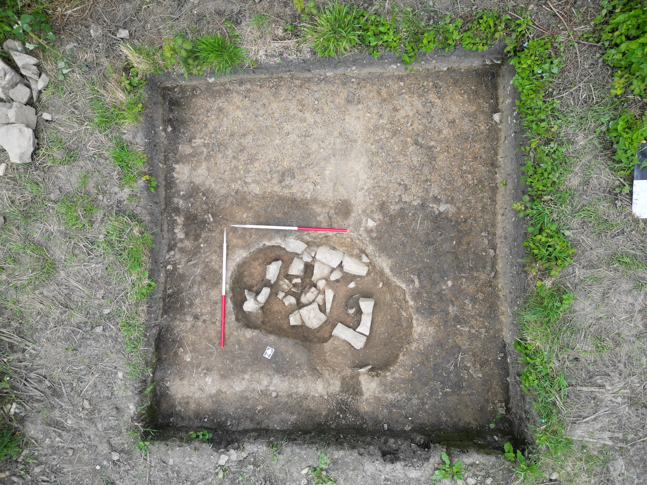
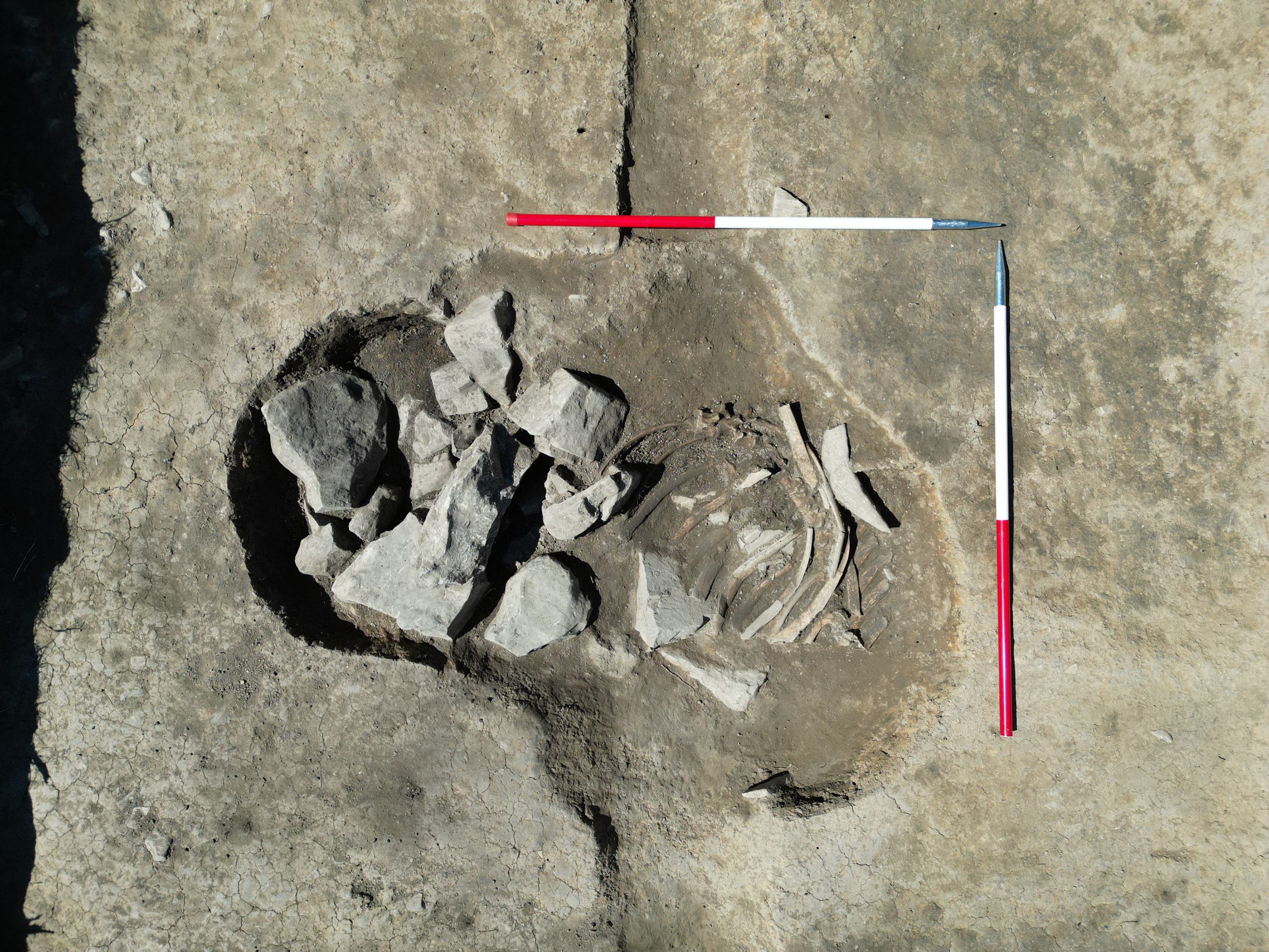
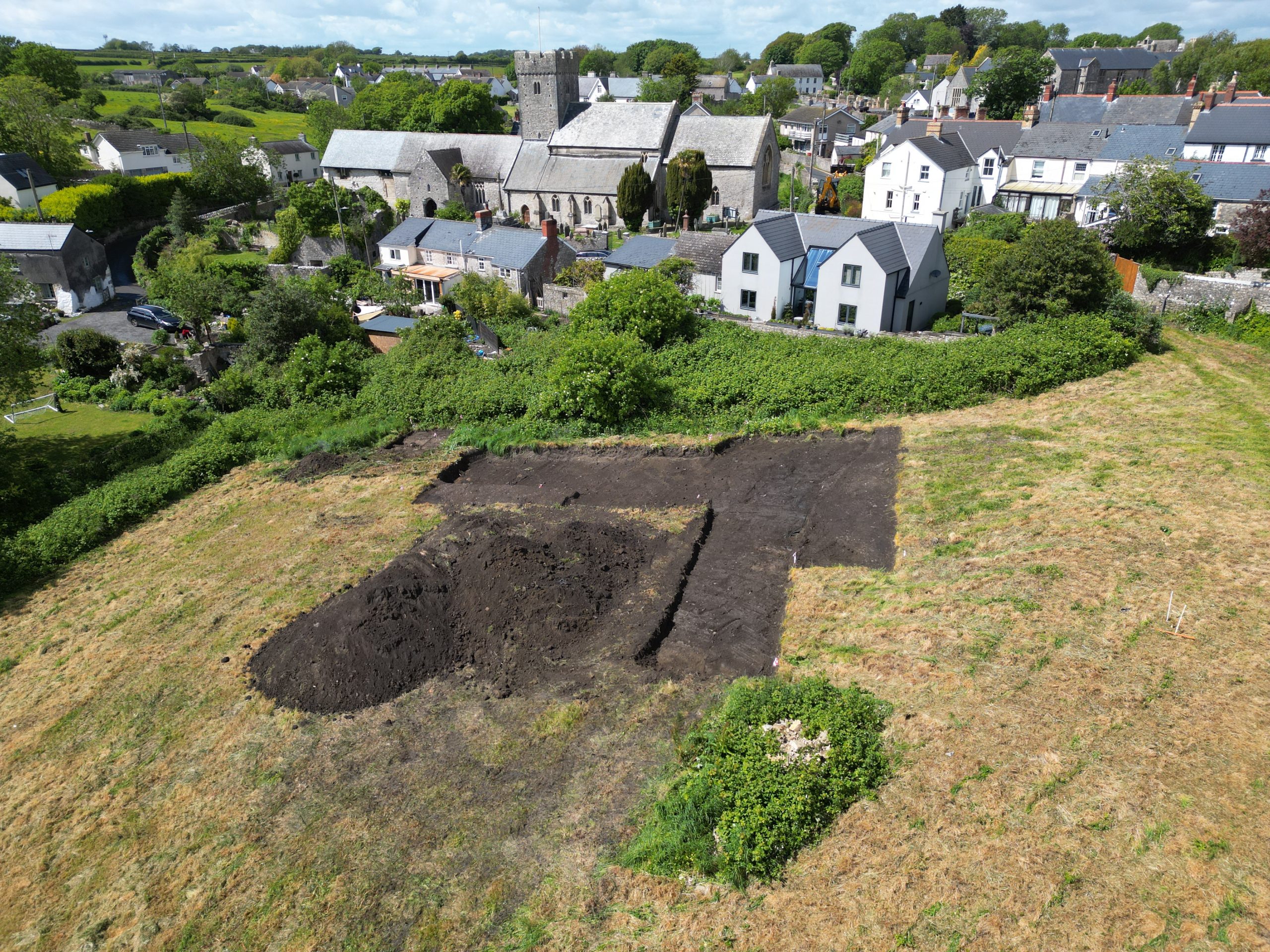
The ‘cow pit’, now interpreted as a soakaway, has now been half-sectioned – and had fish bones to very base. In the north of the smithy area, an are of dark soil proved to be the unexcavated base of the northern of the two medieval soakaways excavated in 2024. With the other two soakaways now having produced interesting fish bone assemblages, this unexpectedly gives us another opportunity to sample the very base of this one. The last remaining undug early medieval feature in this area proved to be a a posthole for a very substantial square-section timber. This lies exactly on the line of a linear gully passing southwards – so it is tentatively interpreted as the corner post for a building with a wall founded on a timber sill beam – the probable wall that separates what we currently think of as the smithy building to the east from the yard surface to the west.
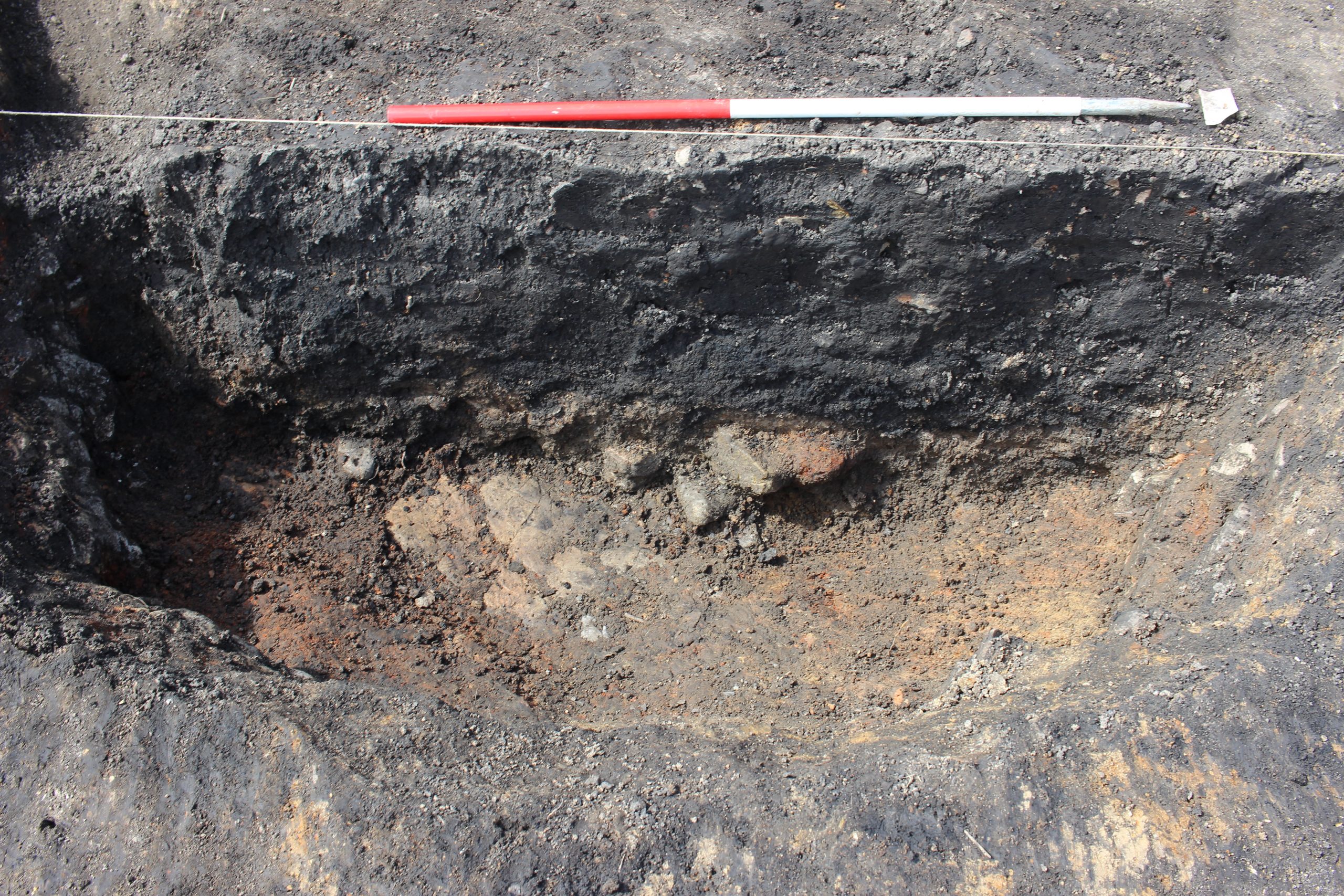
At the southern end of the same gully, the gully passed over a pit with abundant hammerscale, in turn next to one (or possibly two) shallow hearths with slag. The hearths in turn overlie the fill of a grave. This should provide some dating for the construction of the building an the phase of ironworking that preceded it. The relationship between the blacksmith’s hearth and the grave has generated much discussion – the southern margin of the two follow the same line. The bones in the grave lie just a few centimetres below the hearth. Was the grave still a hollow when the hearth was dug? Was it just softer ground to dig out for the hearth? Were the smiths aware of the grave just below their feet? Why were graves in this area so shallow – or was soil removed from the are after the graves were dug before the smithy was built? Whatever the answers to these questions, it is clear that the living and the dead occupied much the same space!
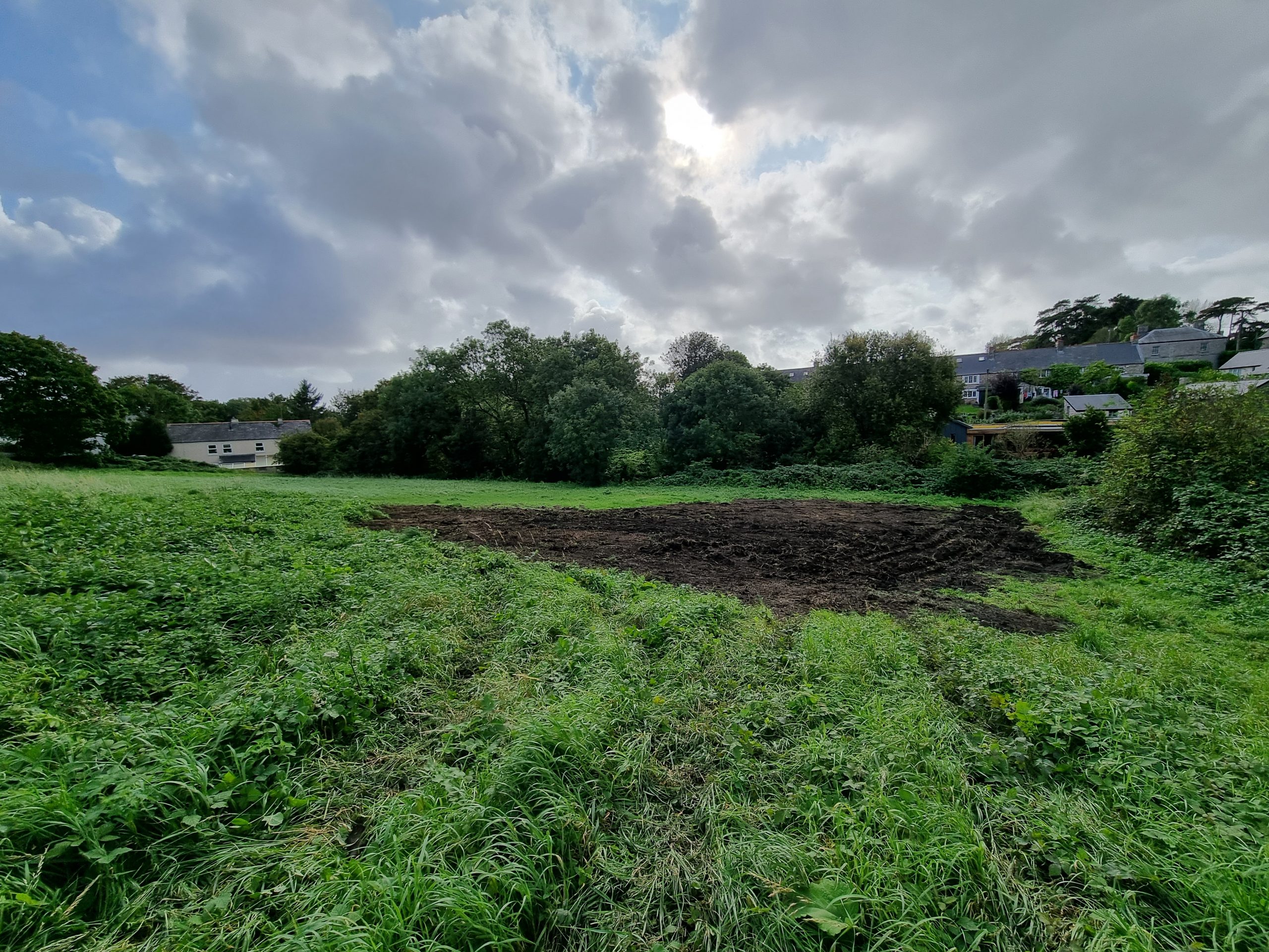
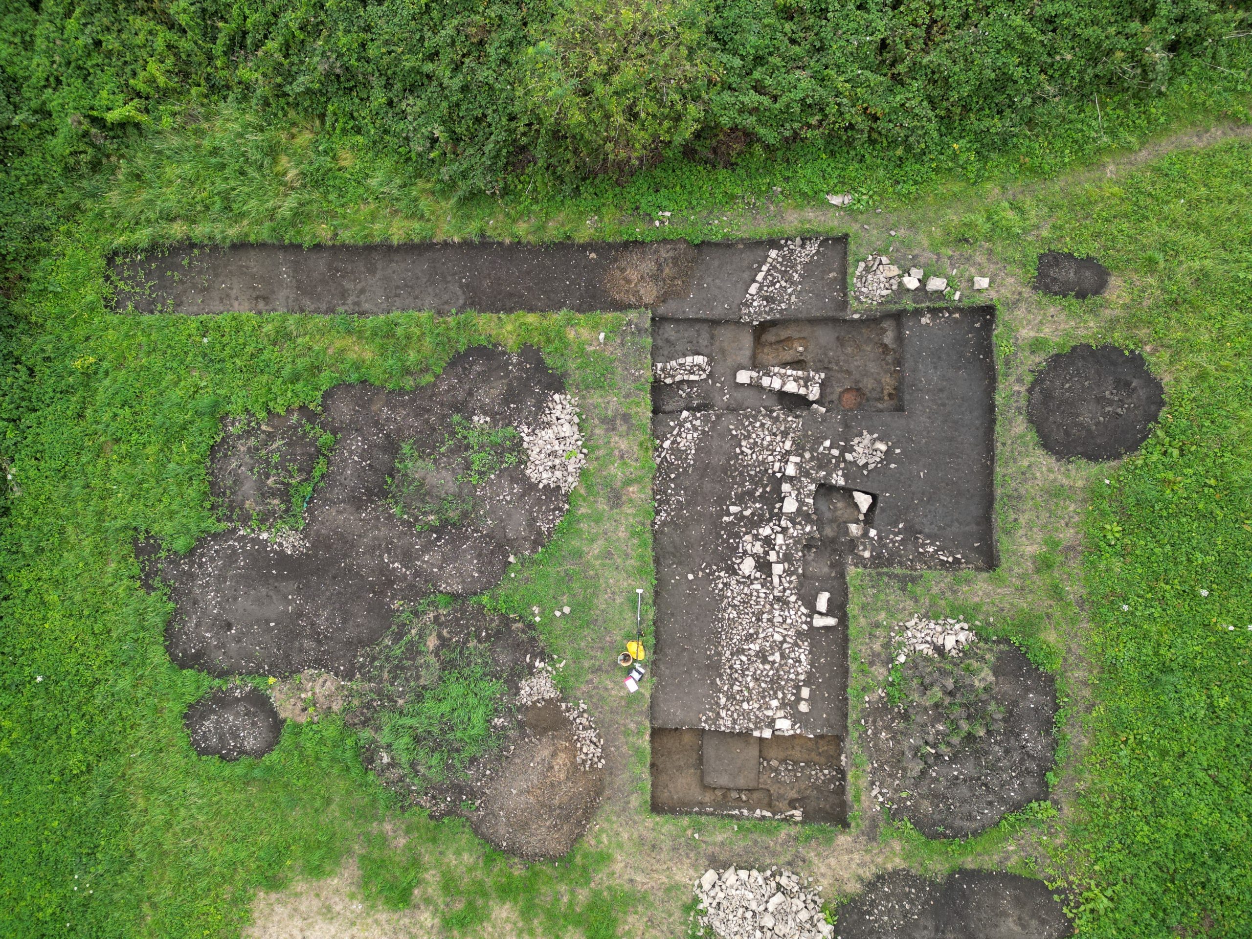
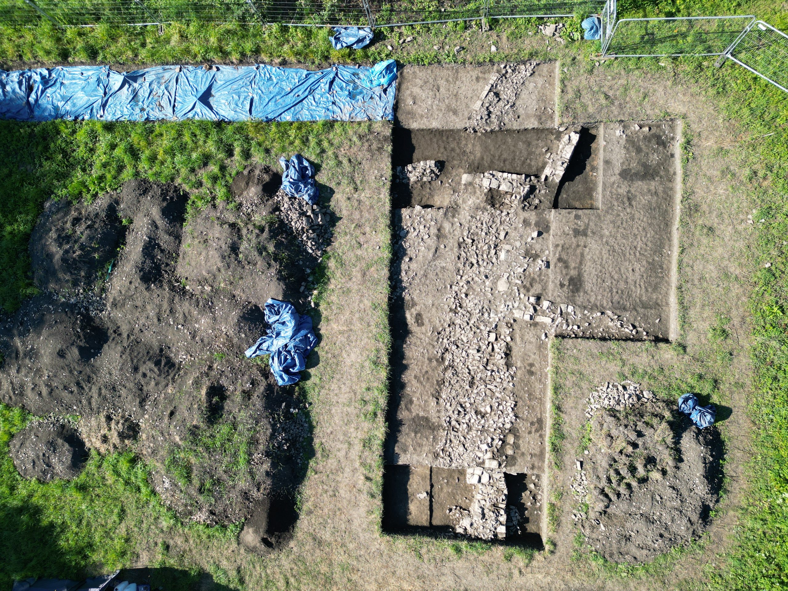
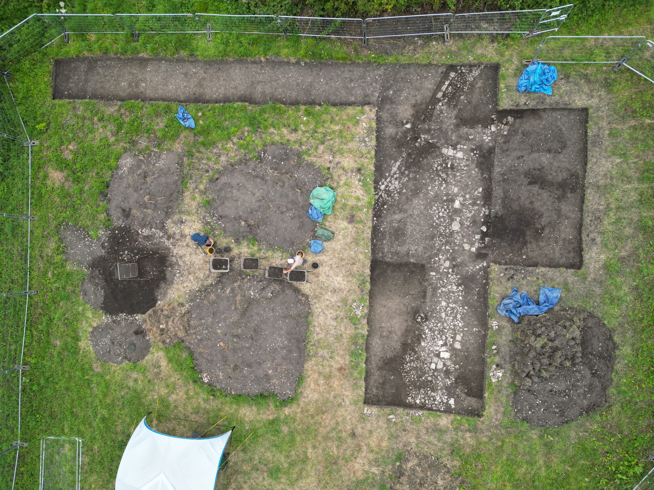
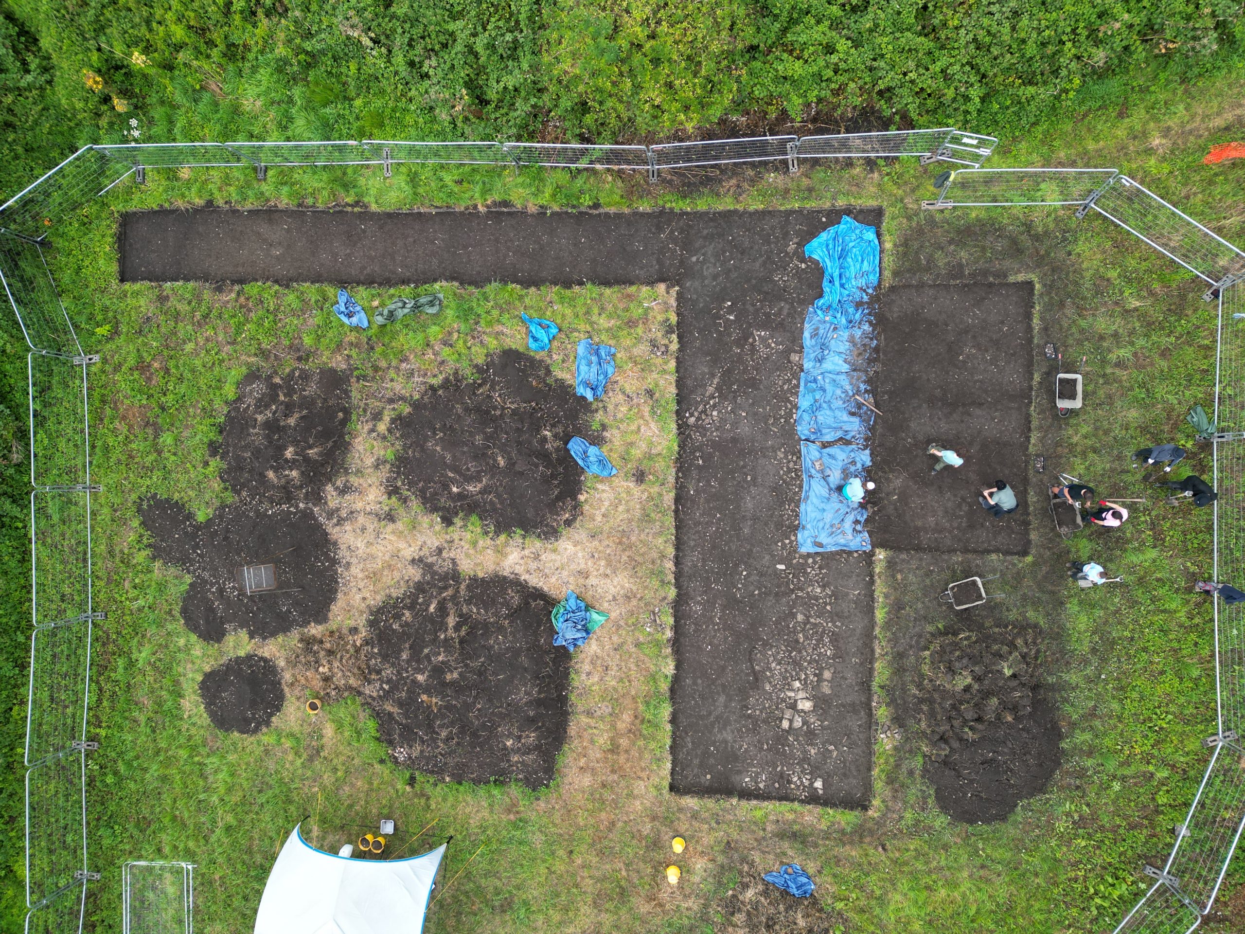
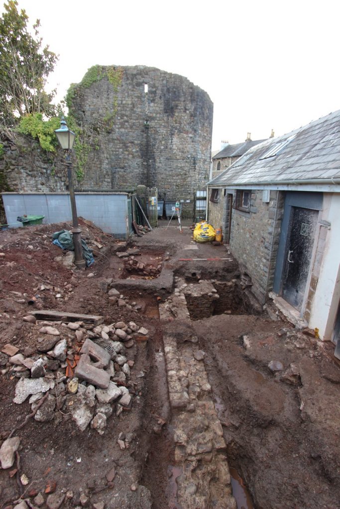
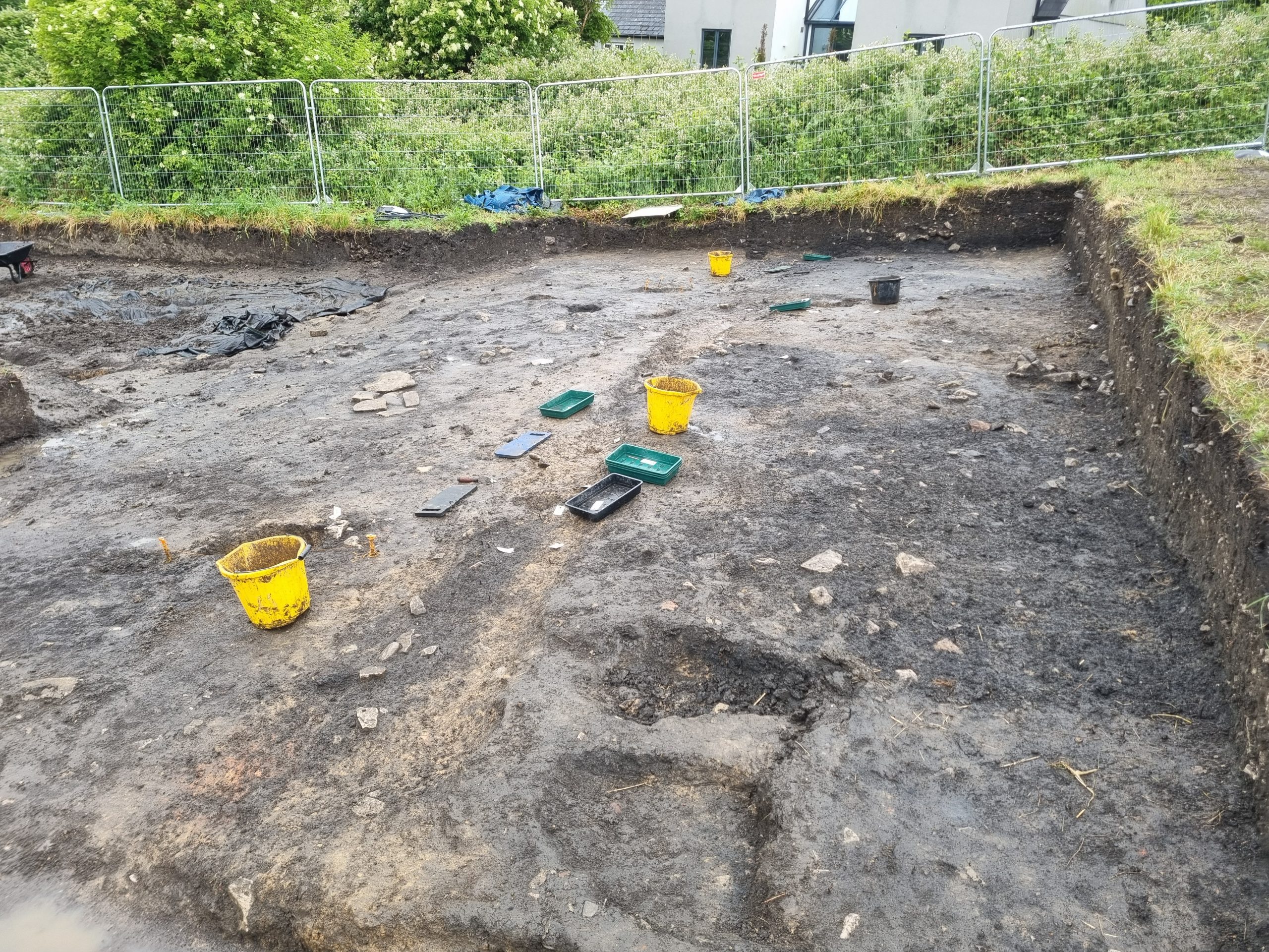
19/6/26: with a break for a rainy day on Wednesday, work has continued towards closing down the site. The ‘cow pit’ soakaway has grown ever deeper, but we think the bottom is now finally in sight. Within the smithy area, the significant thickness of deposits in the possible yard area have now been reduced down to the point at which the underlying features are becoming visible. Within the possible smithy building area, the interesting finds continue to mount – including a small fragment of sheet iron and a crucible handle. With just a few days left, it is coming to the point at which hard decisions have to be made about which areas can be finished and which we will have to be re-covered and revisited next year.
16/6/26: work continued in areas of the smithy and in the ‘cow pit’. After days of trying to explain the unusual ‘post-hole’ in the cow pit and its relationship to the cow thorax, it now seems we may have been thinking in completely the wrong direction: the pit is increasingly looking as if it does not contain a posthole after all. The structure of the pit now resembles one of the two later medieval soak-aways that we found two years ago. Like that much younger pit, it shows very coarse and crude blocky stone lining, with a jumble of large rocks internally. Also like the previous example, it has proved to be rich in fish bones. However, unlike the later medieval example it also appears to contain a deposit of ash, even though the pit is not burnt. Whatever it was used for, the similarity with the other example that is some 500 years or so younger is striking!
In the metalworking area, a nice assemblage from copper alloy working was located. In a very small area, there were two copper alloy tubular rivets, eleven small pieces of copper alloy including both pieces of thin strip (some folded for recycling) and droplets/spills. a sherd of pouring spout from a small crucible and a fragment of a ceramic mould. The mould fragment is the first from the site and although it is not interpretable, we can hope that other similar fragments may perhaps be found within the same feature as work progresses.
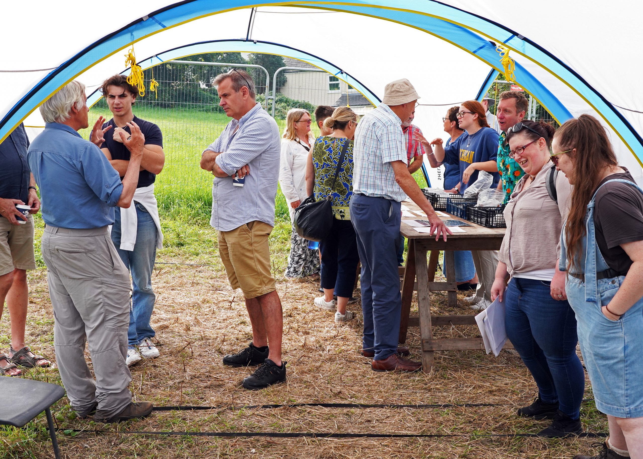
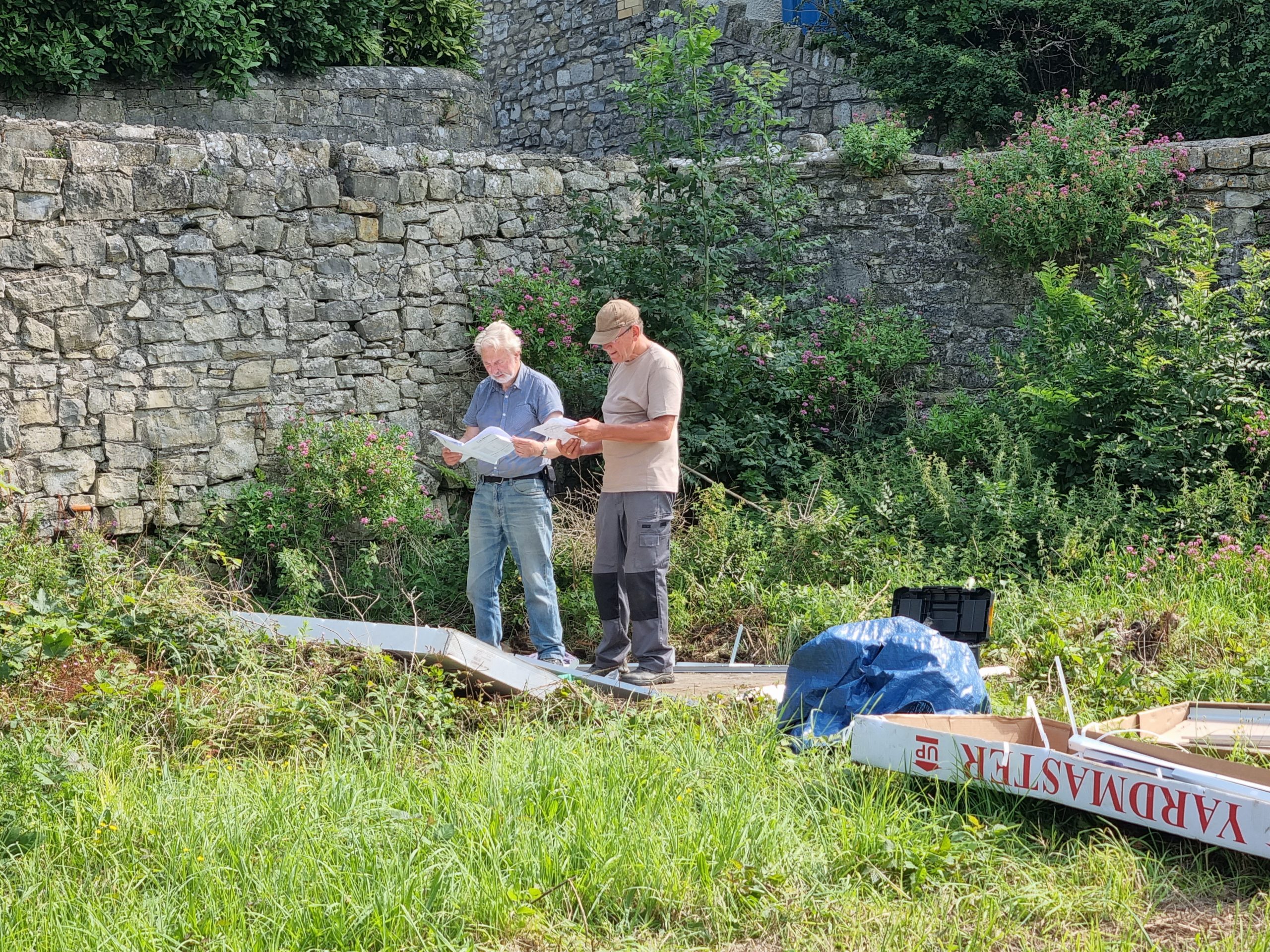
15/6/26: some good progress was made today in completing work on the smithy area. It was also a busy day for visits – firstly from a pilgrimage tour party on the ‘In the footsteps of the early Saints‘, tour for whom the site was an unexpected ‘extra’, and secondly from members of the site owner’s family. Work also continued with the washing of the season’s finds. It was also a ‘milestone’ day, because it saw the submission to the Charity Commission of the key documents for the new ‘Llantwit Major Archaeological Trust’ . The Trust will become one of the major funding vehicles for the Globe Field excavations.
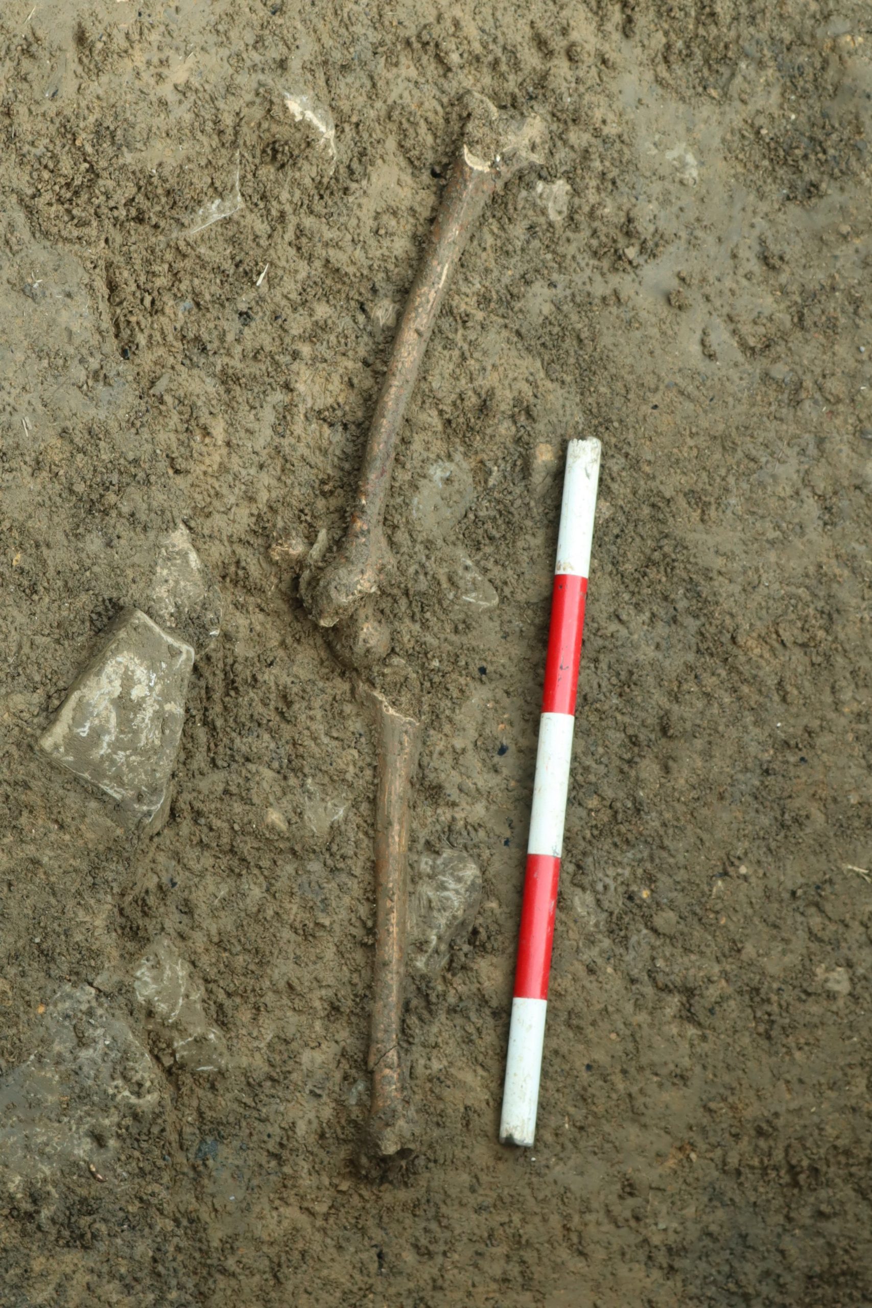
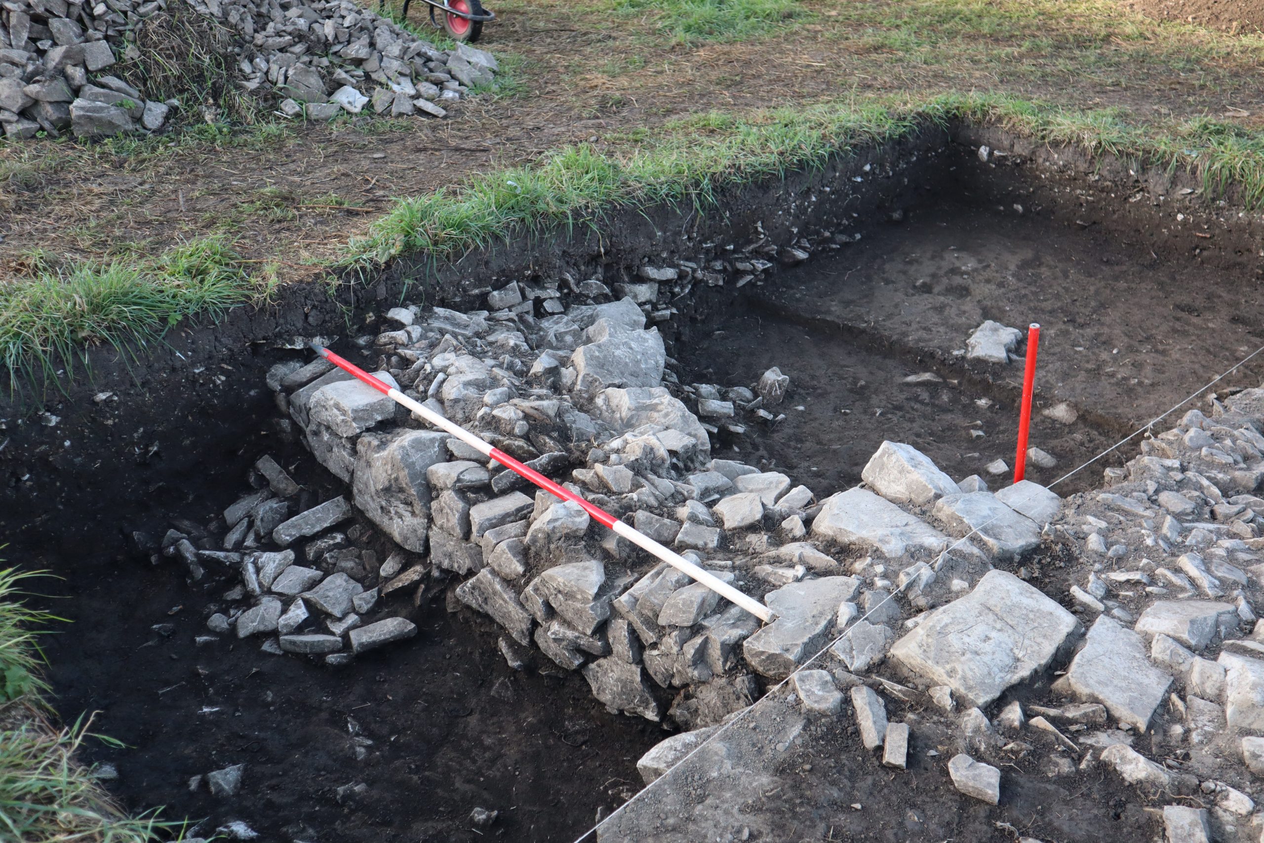
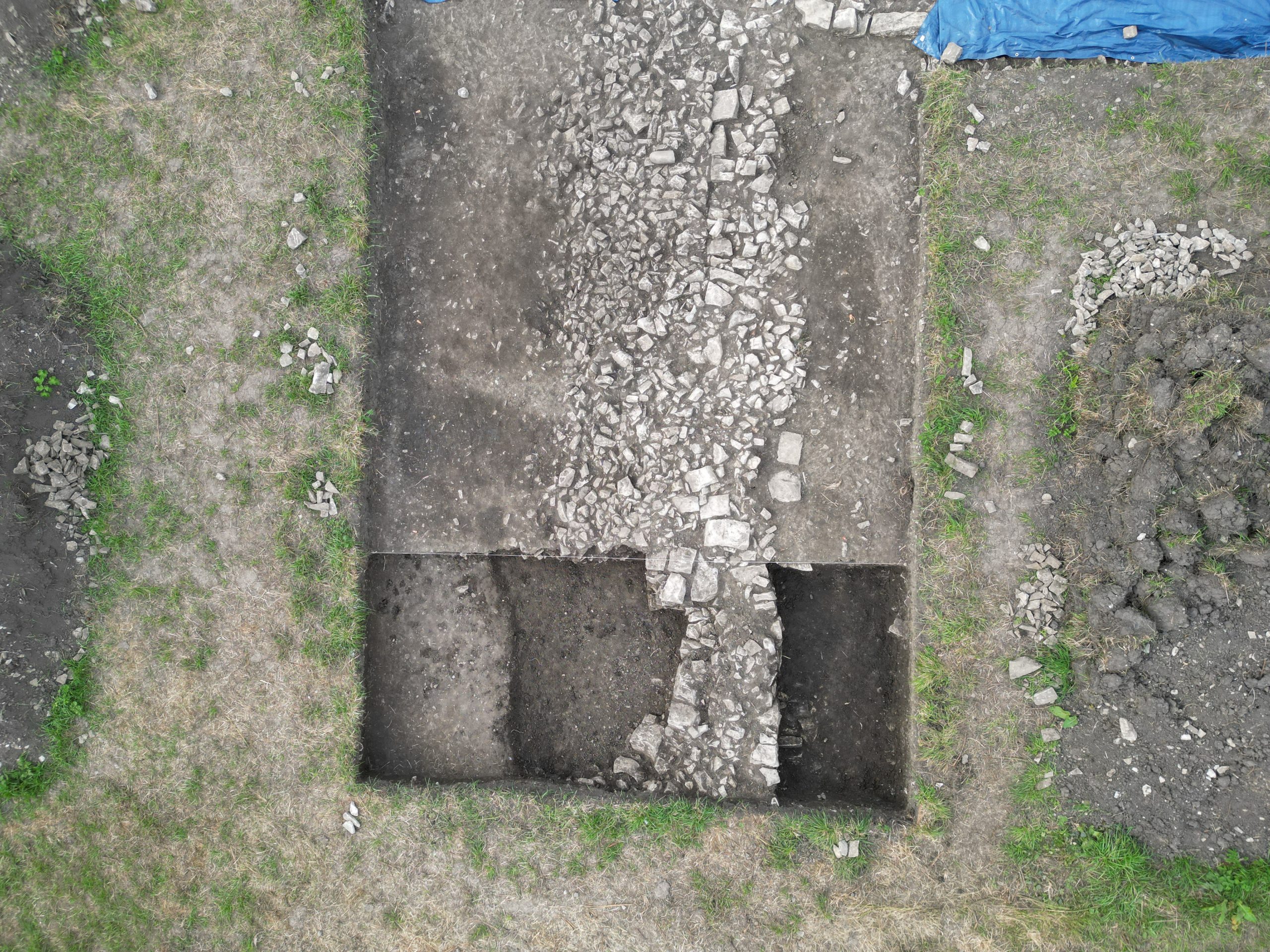
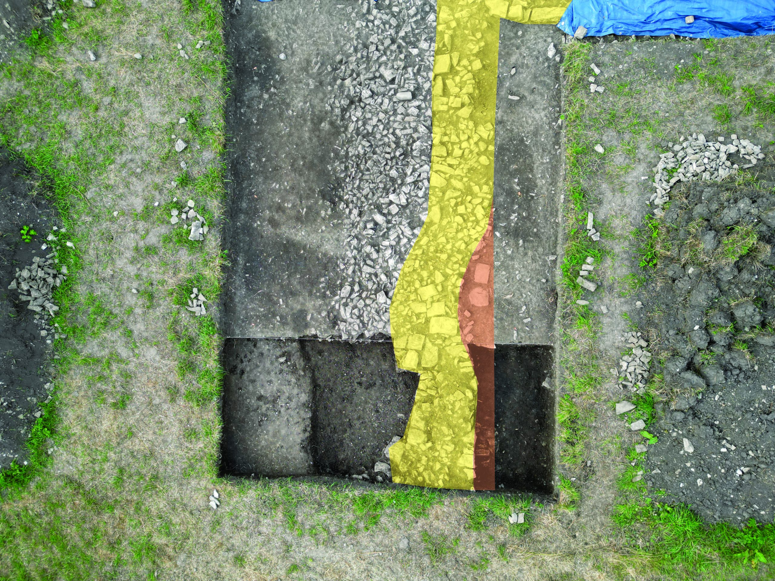
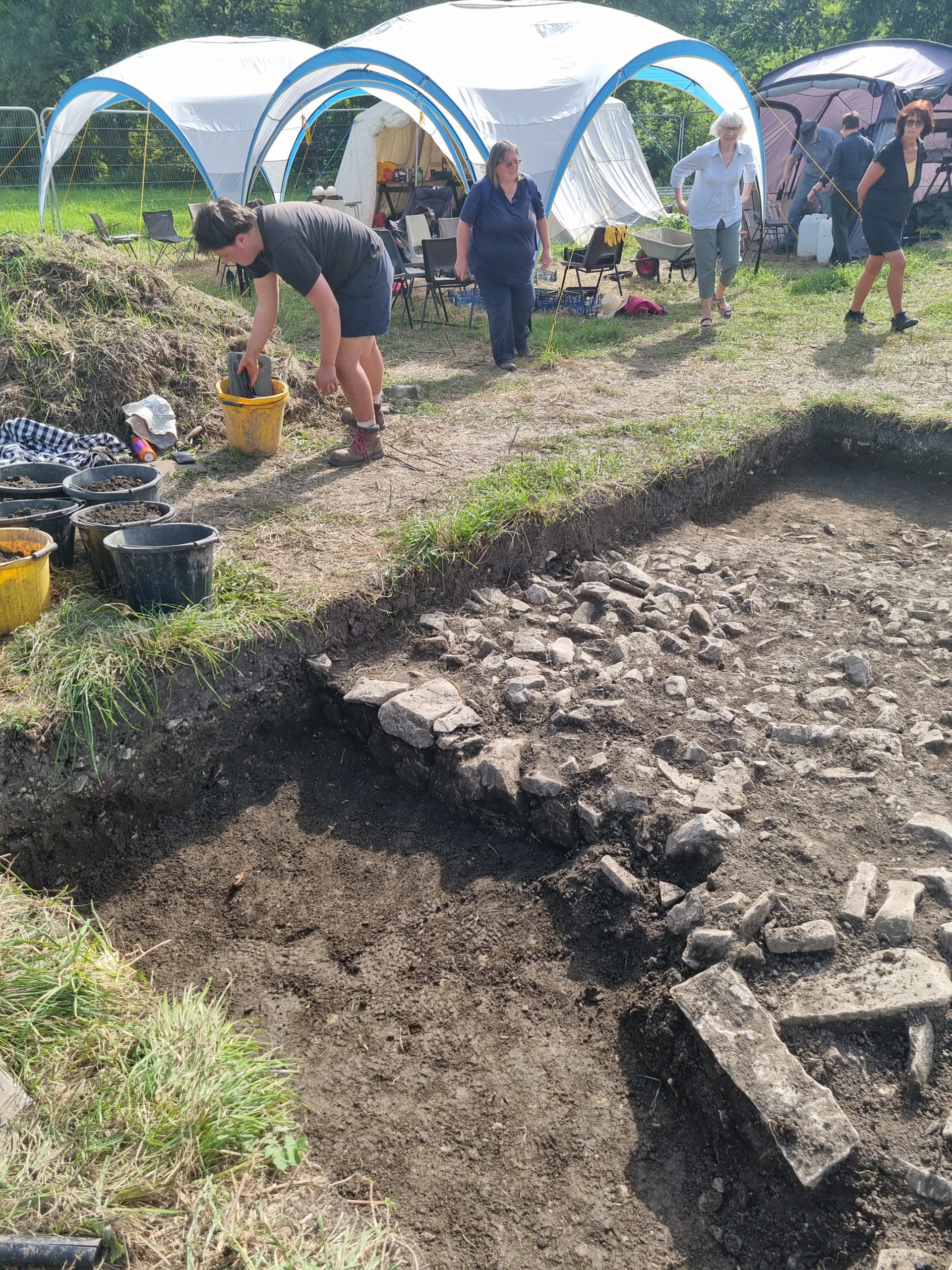
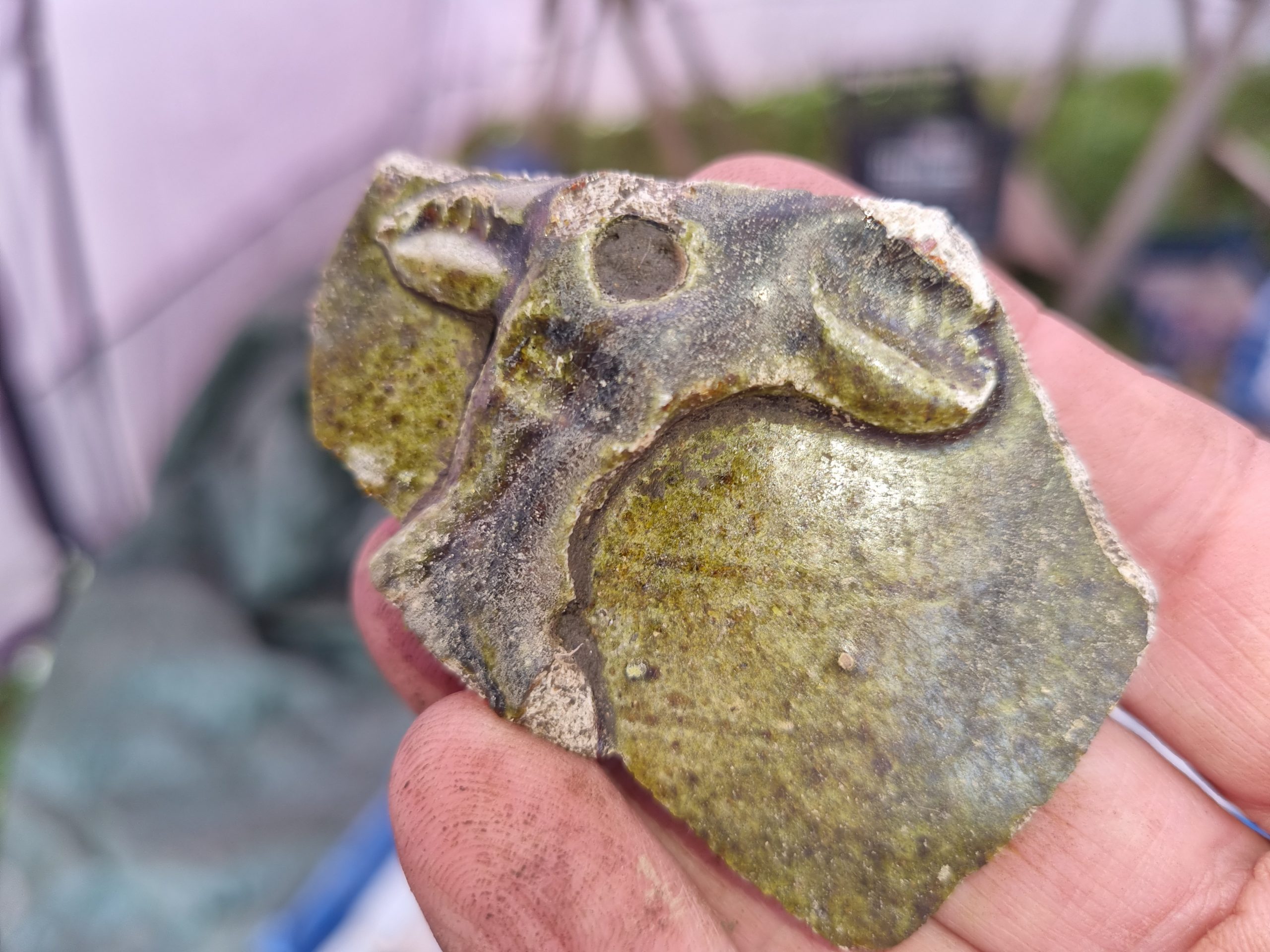
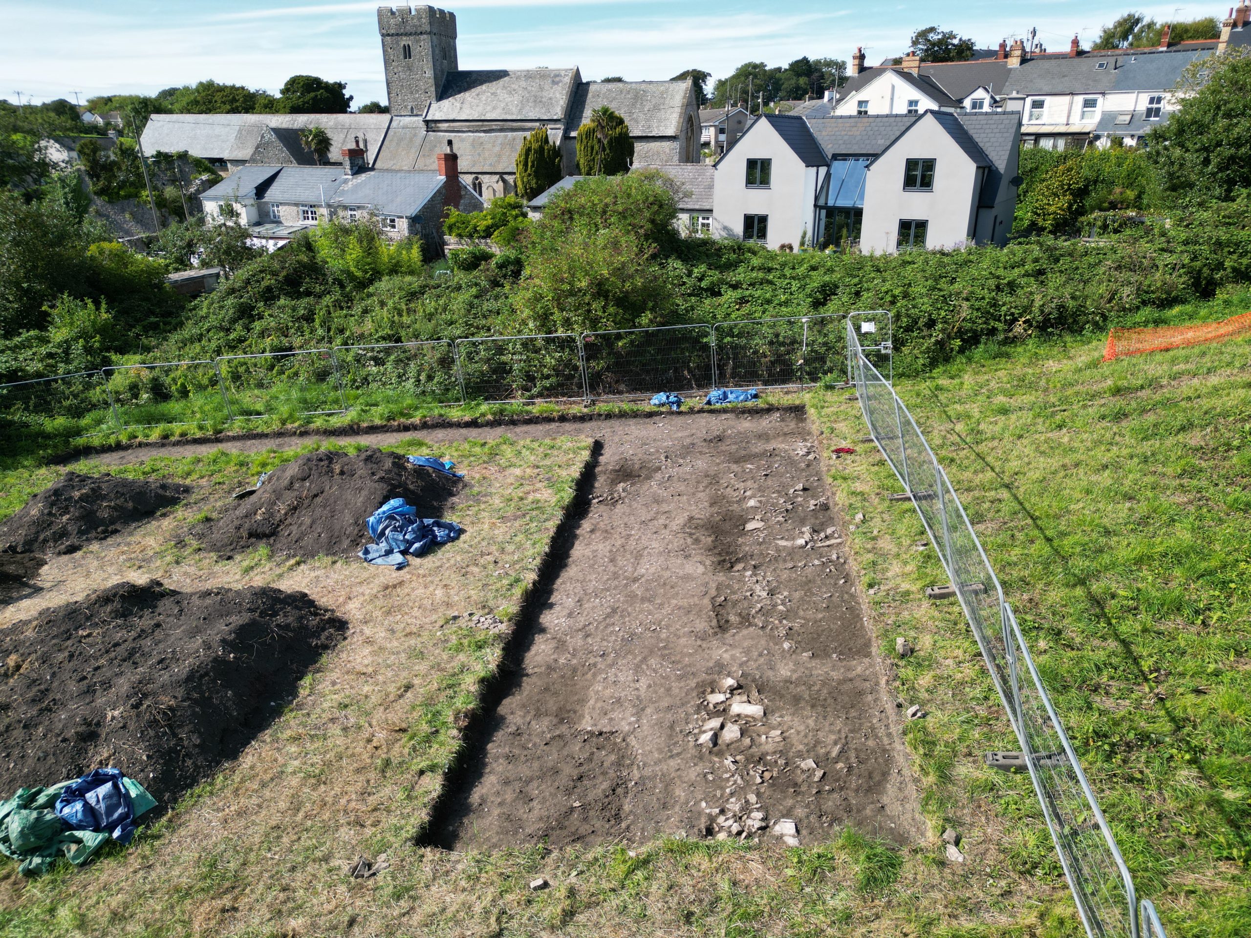
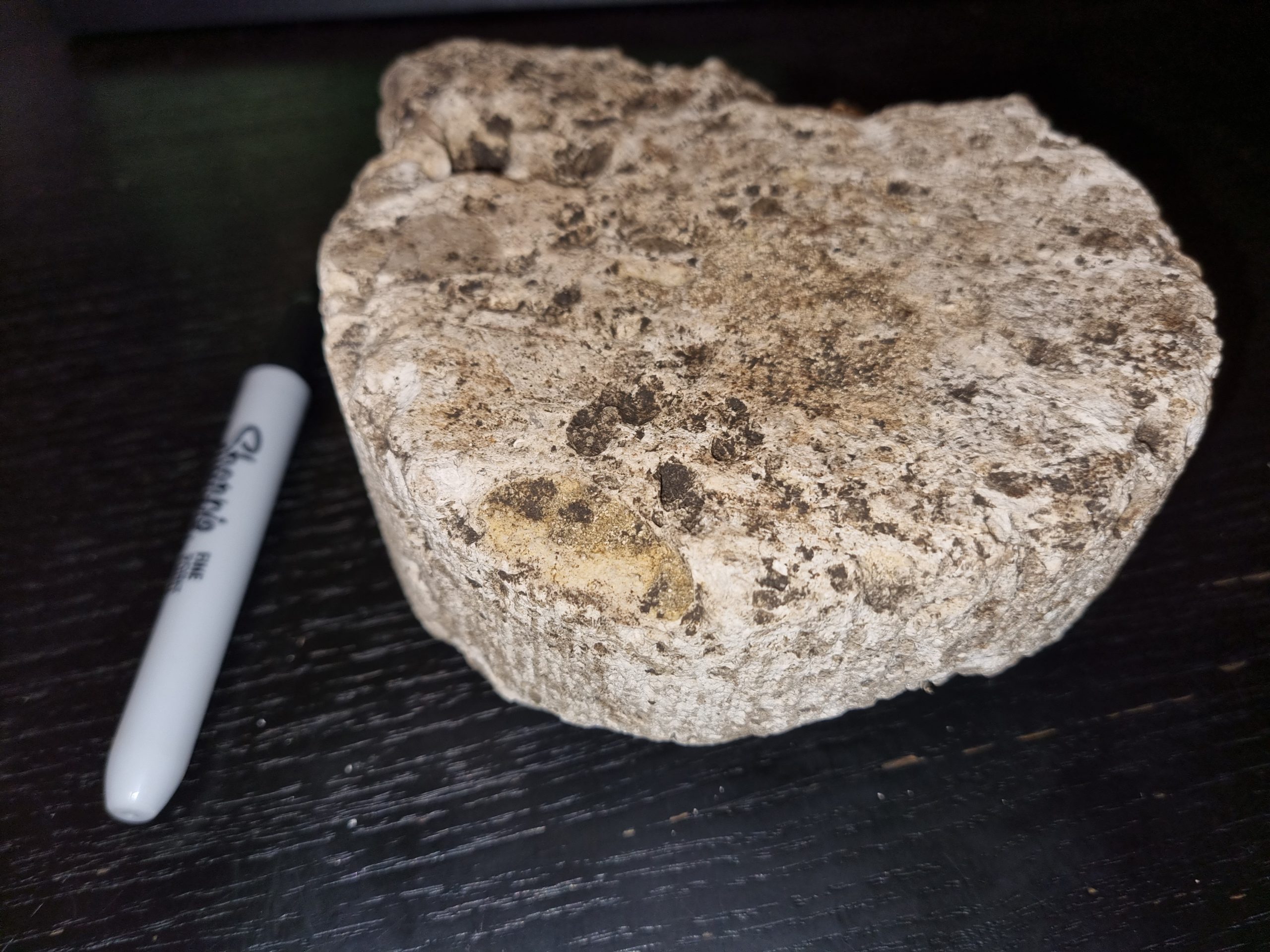
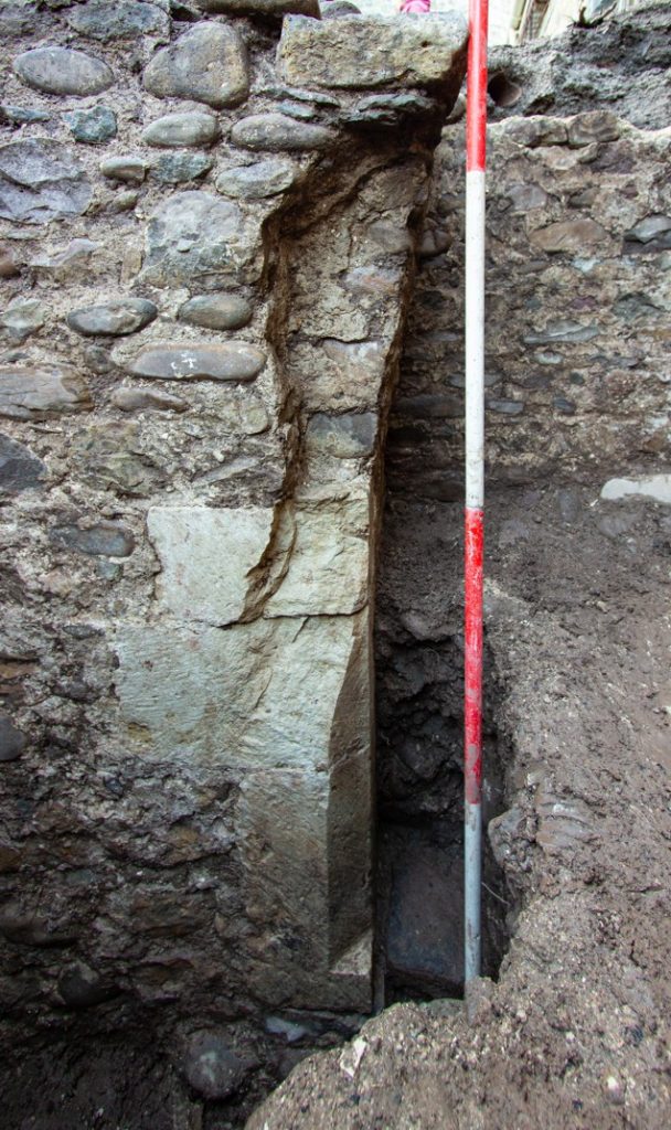
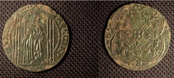
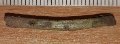
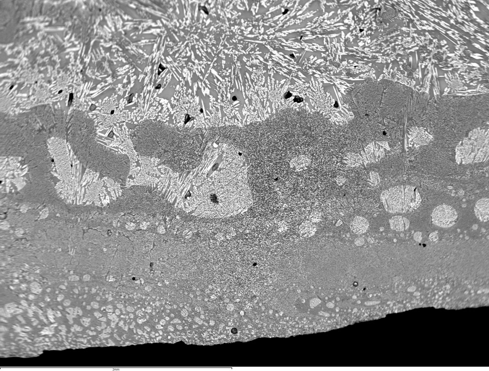
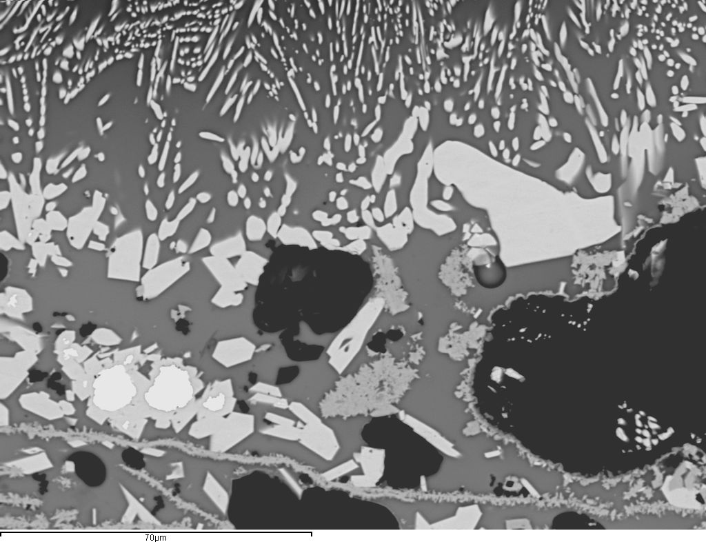
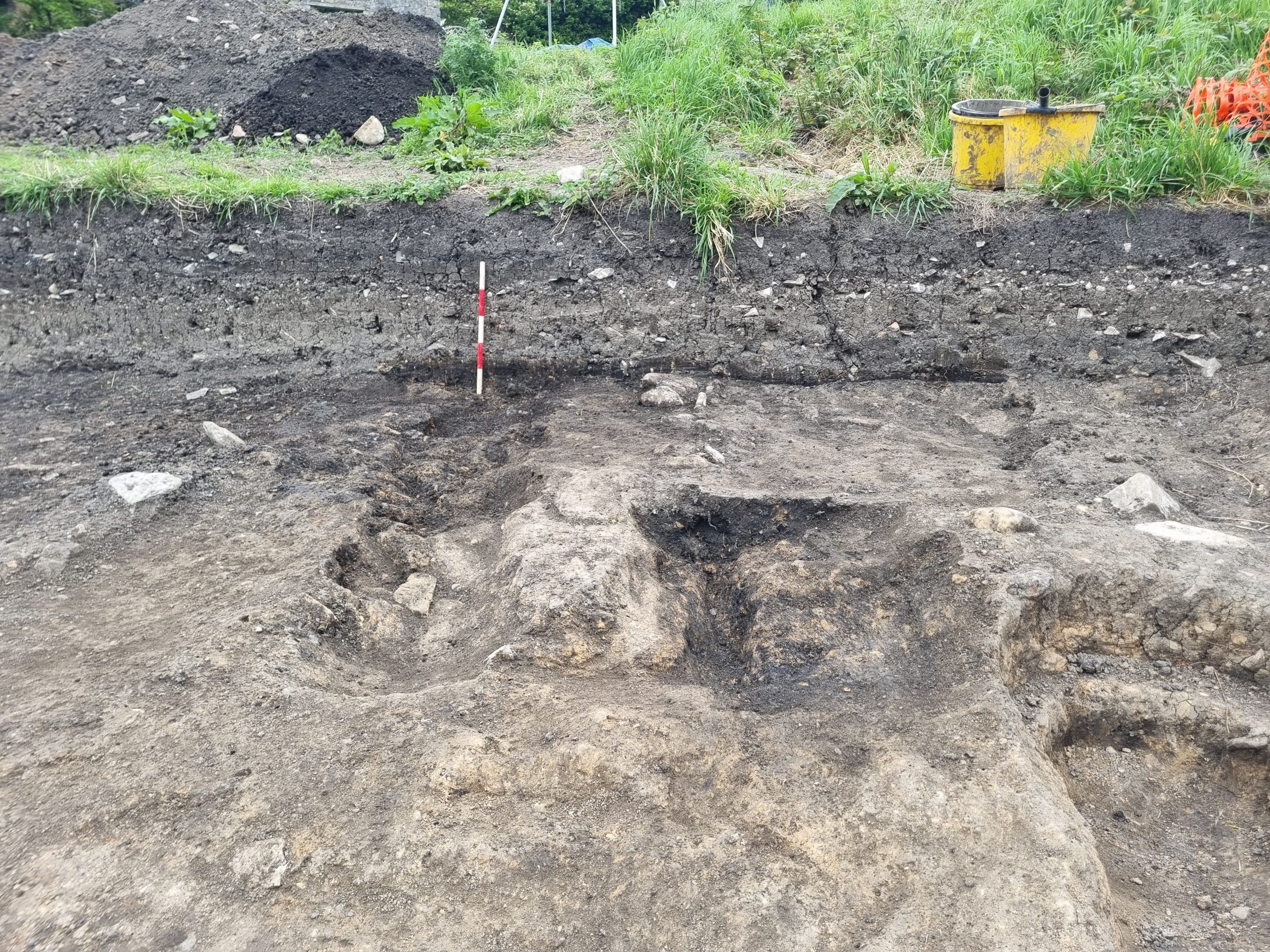
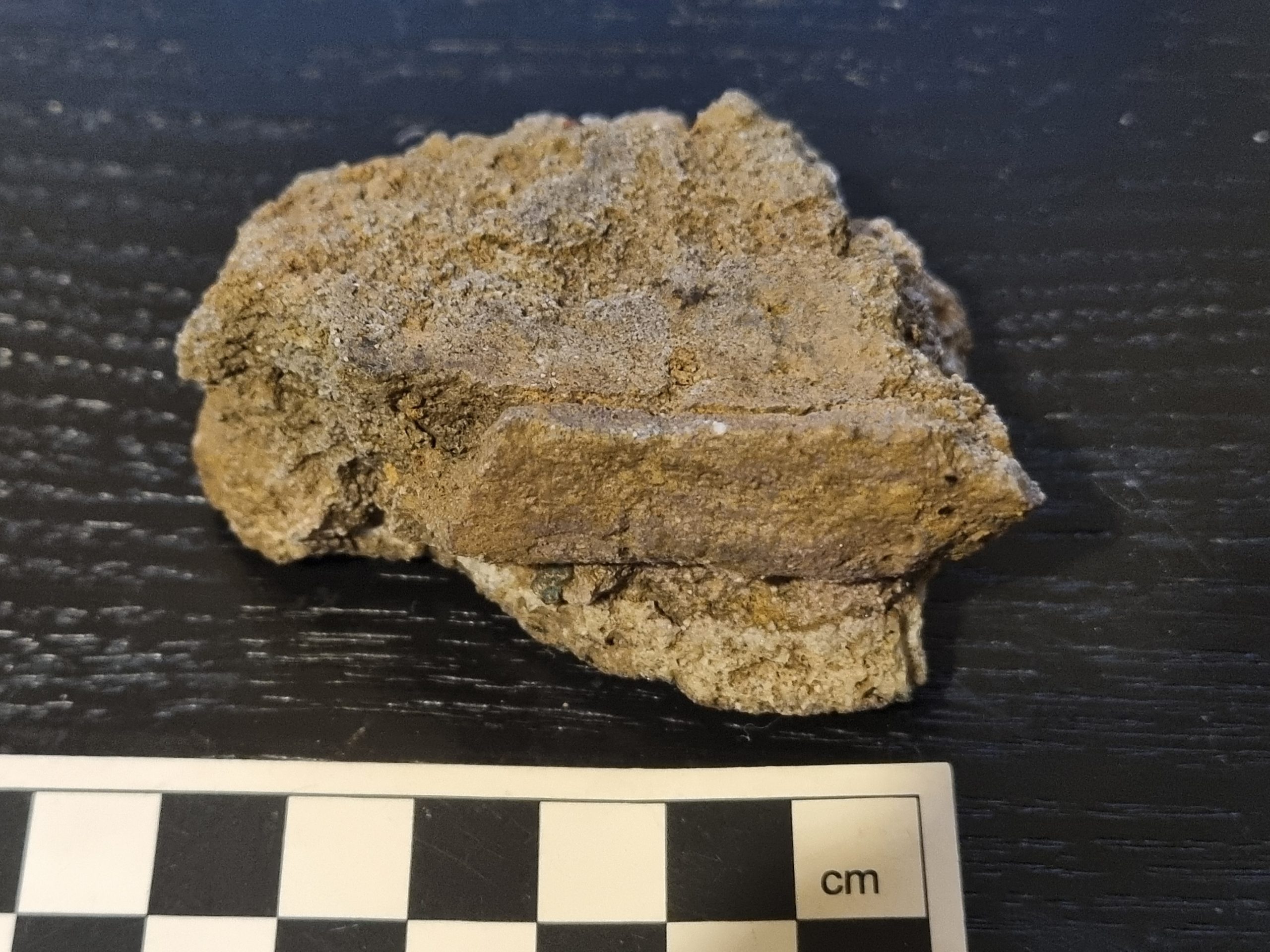
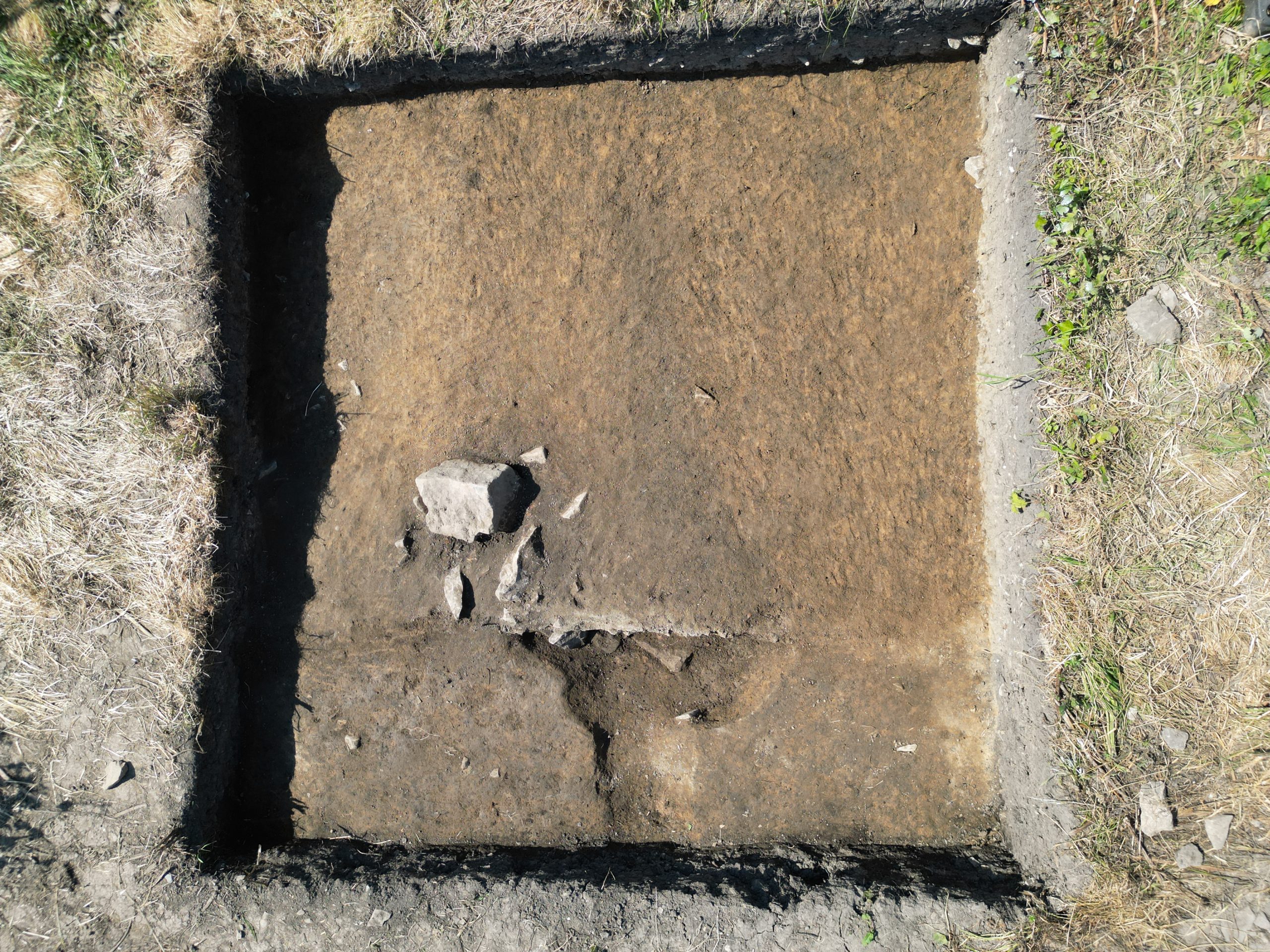
13/6/26: today was the start of the process of finishing off certain parts of the site as well close it down. Part of today’s work involved excavating to the base of the northern (inner) boundary ditch, Ditch (6139). This proved to be approximately 1.9m deep – a substantial feature. Much of the ditch was filled by the dumping of large limestone blocks from the south – possibly as the result of collapse/demolition of a drystone wall between the two ditches. The silts around these blocks had already produced several fragments of brazing shroud (a clay coat applied to an iron object during the process of brazing, coating of the iron in bronze) and even several fragments of brazed sheet iron. Today, a horizon of charcoal and slag below the stone backfill produced a larger sherd of brazing shroud than any of the dozen or so pieces that we have had previously and which provides the strongest evidence yet that the brazing was undertaken as part of the fabrication of iron handbells. This fragment apparently shows the clay coating from the lower part of an iron handbell, including the curved external surface of the lowest clay coil.
Not only does this allow us to be confident in identifying our Llantwit smithy as having produced ecclesiastical handbells (probably in around the late 7th century), the first such operation identified outside Ireland, but it also provides technical details on the way the clay coating relates to the lip of the bell and even on the orientation of the bell during firing – details that were not certain in the materials from the two important Irish sites at Clonfad and Gortnahown.
In 2007-9 we conducted experimental campaigns (jointly funded by the National Museum of Wales and NRA/Westmeath County Council) to attempt a reproduction of the brazing process as evidenced by an almost complete clay coating (shroud) from a mid-7th to late 8th century pit within the monastic site at Clonfad, Co. Westmeath. Whilst undertaking those experiments in the St Fagans Museum, little did we know that a contemporary site, less than 20km away, had been producing bells with exactly the same technique!
12/6/26: the final day of the student placements. After yesterday’s washout, with no digging achieved (though a lot of paperwork was caught-up on) at least some digging was undertaken today (but site conditions remained atrocious).

Three areas were worked on – the ‘cow pit’ in Trench 6 where the stone fill becomes more mysterious, a series of small cut features in the N part of the metalworking area and the northern of the two ditches. The ditch continues to provide large amounts of horn core and some antler – as well as a small amount more brazed iron sheet. The ditch was still not bottomed – and probing suggests there is an another 300mm or so of fill to be removed – giving the ditch a total depth of close to 2m.
By the time we emerged from the trenches for the final survivors’ photo quite a few of those on site today had already left, but many were still there…
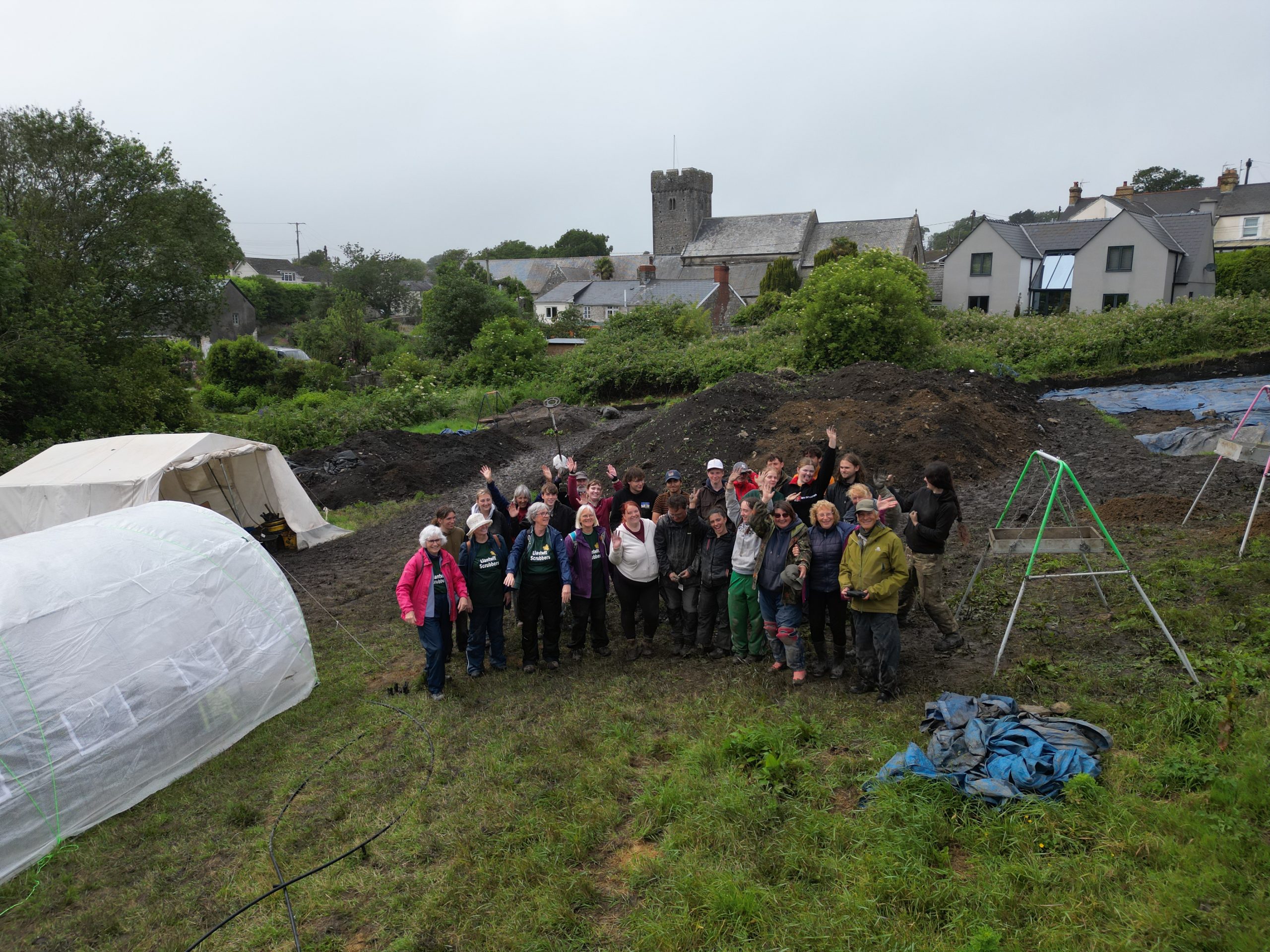
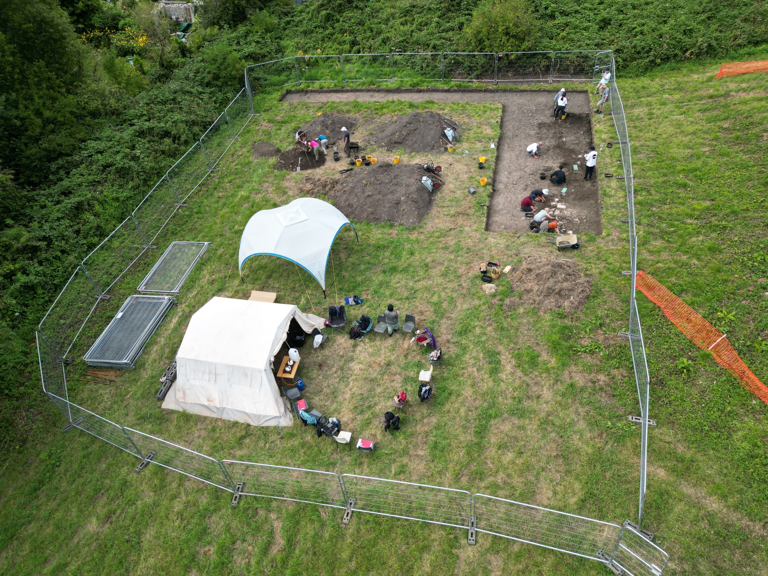
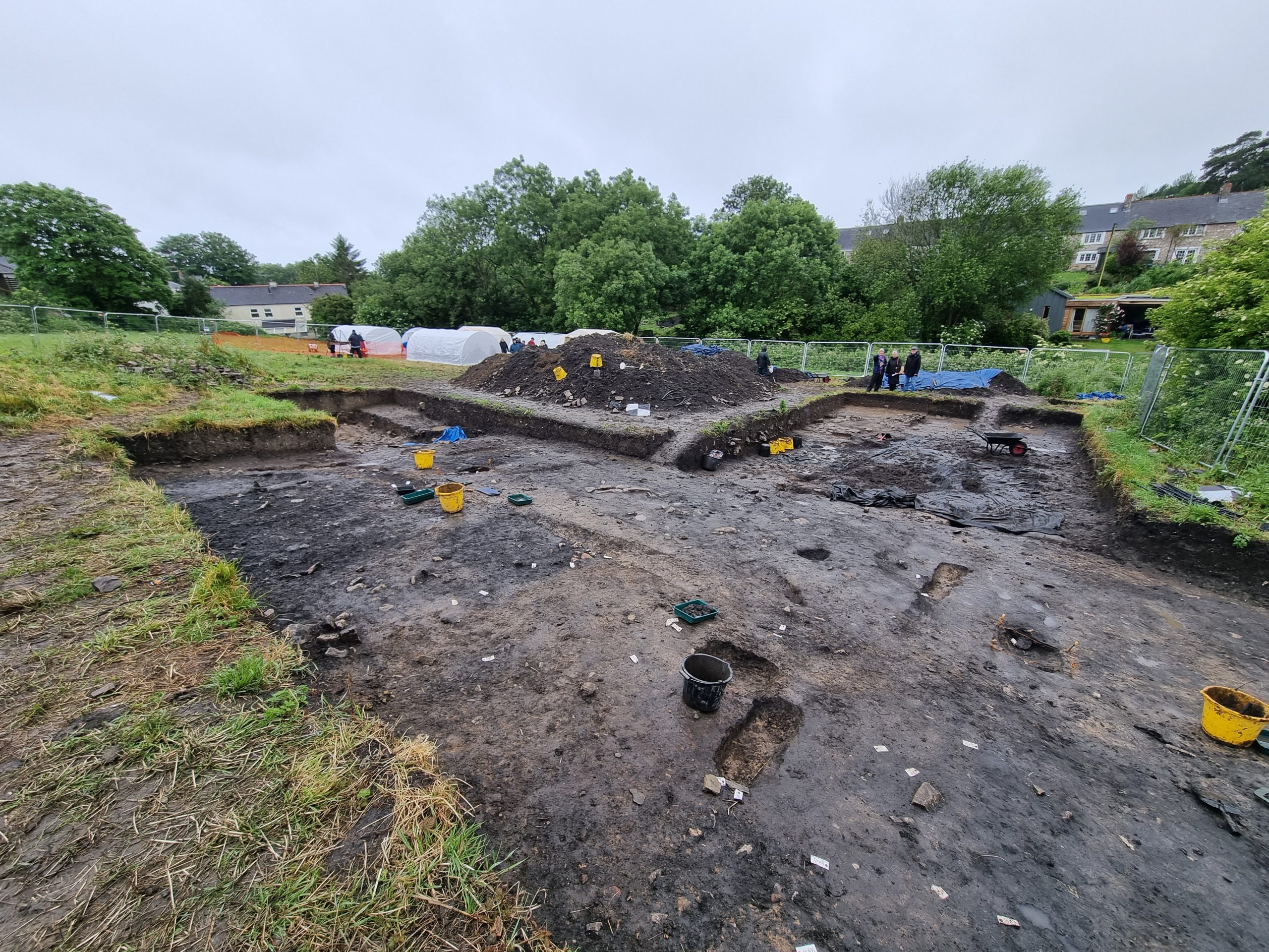
Some thoughts about what this season has achieved will be posted soon, as a few last questions get resolved by a small team in the coming days. Thank you to all the 15 students on placements, 11 student volunteers, 6 supervising staff and 50 volunteers for your hard work that has made this another successful season.
10/6/26: a great deal was achieved on site today between the showers – and with the end of the formal excavations only days away, that was important. Some complicated and unexpected archaeology turned up today. Two areas that has been expected to be simple slag spreads, turned out to be large burnt pits – almost certainly pits for charcoal production. Such pits are rarely found inside settlement sites, so their occurrence here is most unexpected. When they became disused, they appear to have been used for general slag disposal.
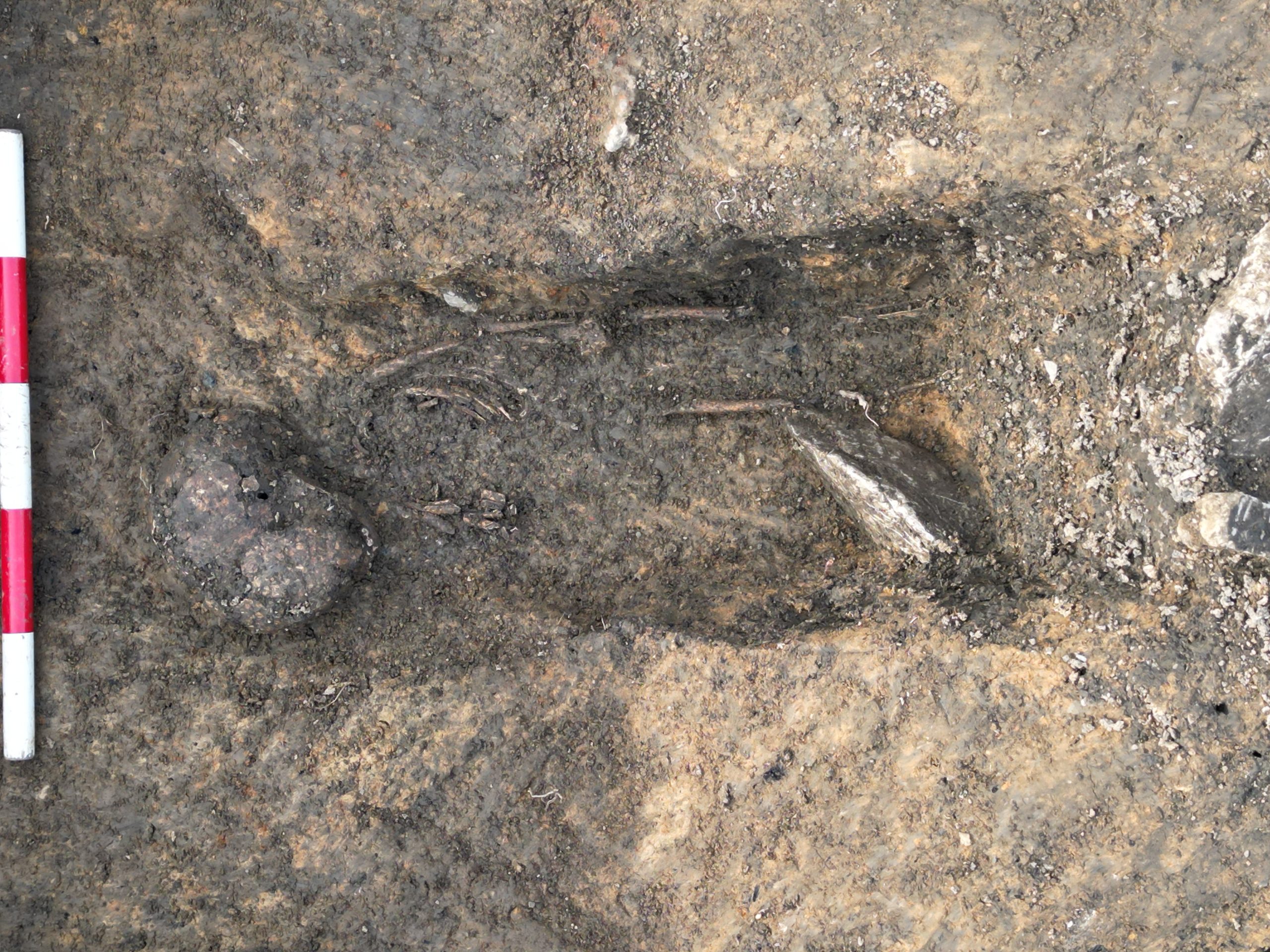
A start was also made on lifting the cow thorax, so we can complete investigation of the underlying pit.

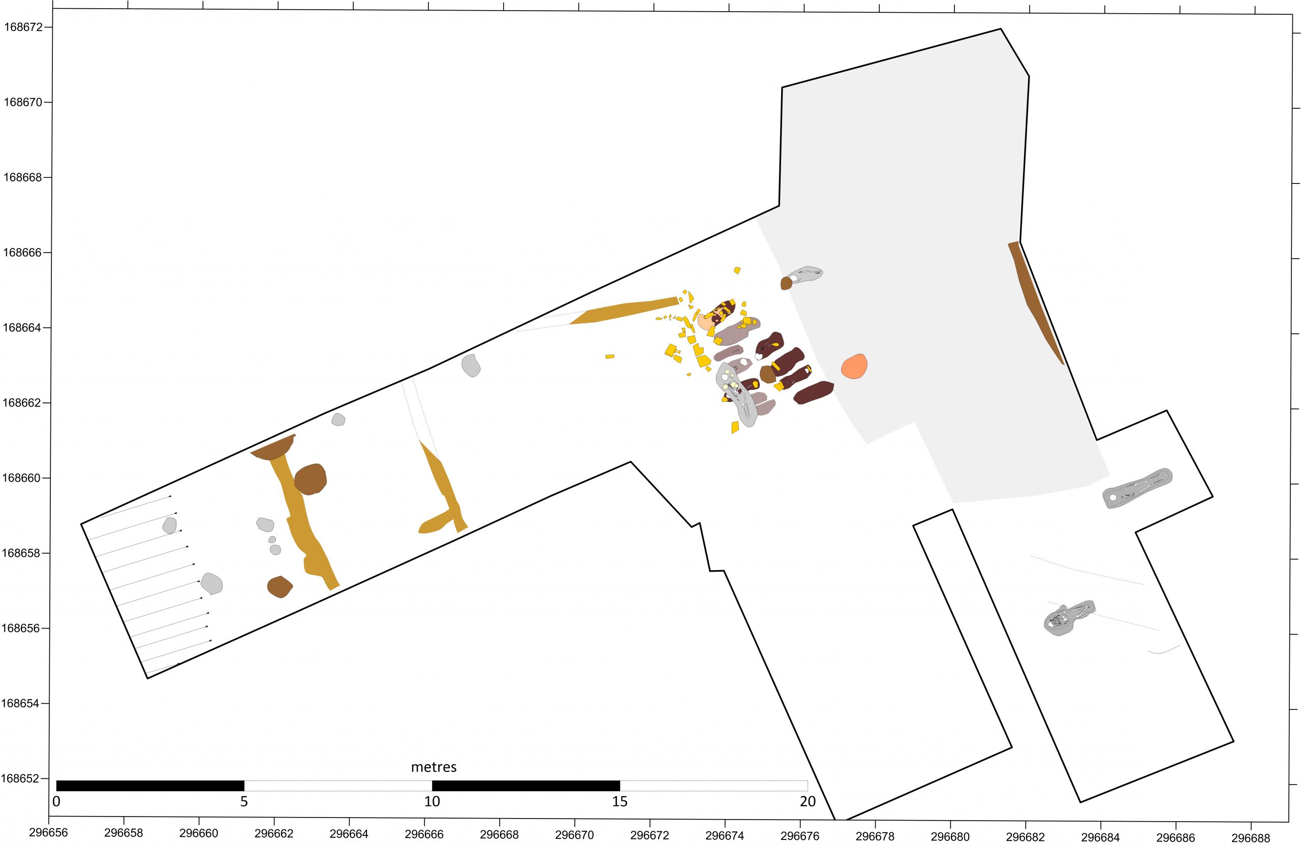
Finally, several new finds of human remains were made today. Of these, the grave of one adult (lying next to a grave previously dated to the late 7th century) may possibly predate some of the metalworking features – further investigation will be needed tomorrow!
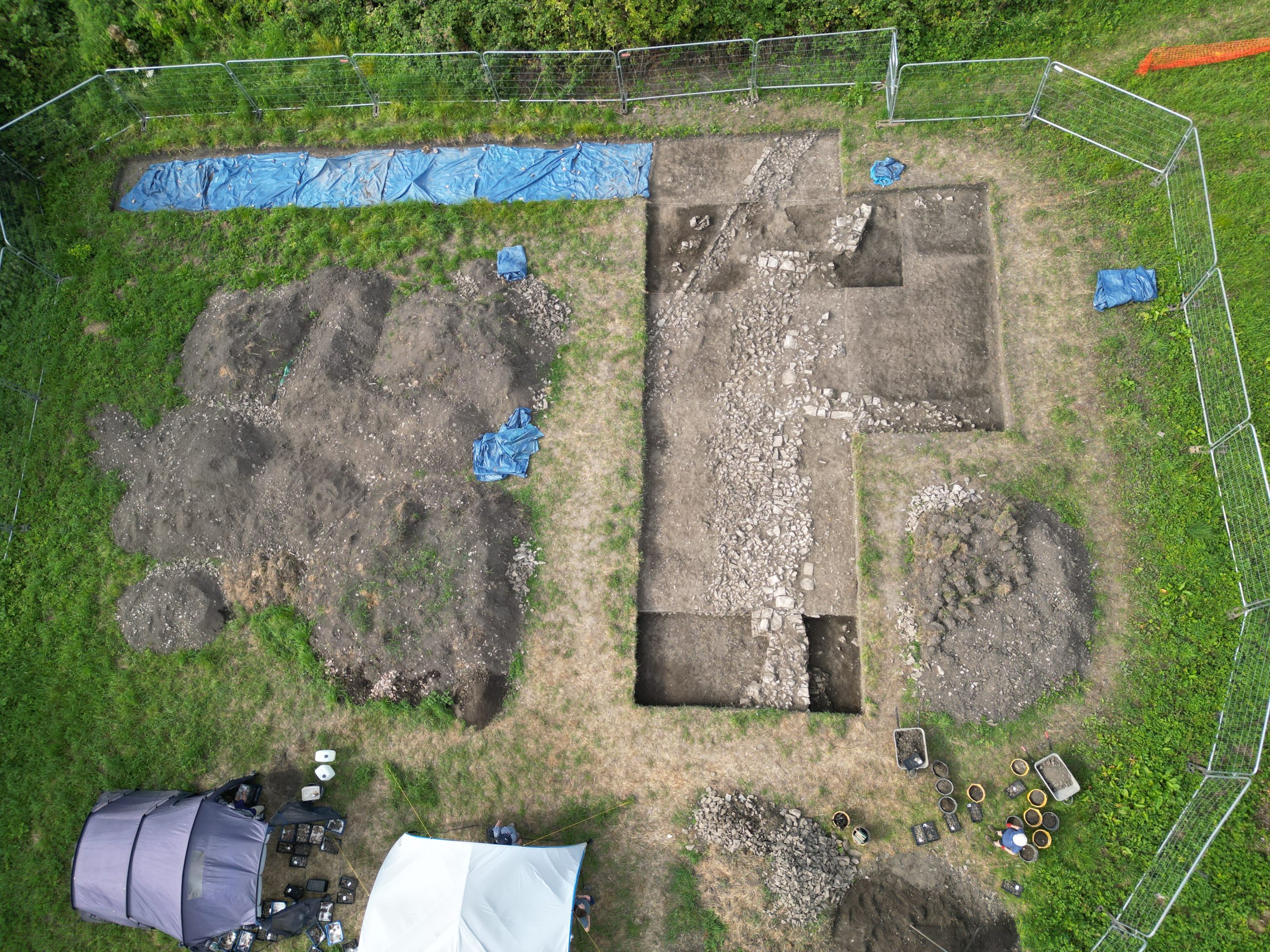
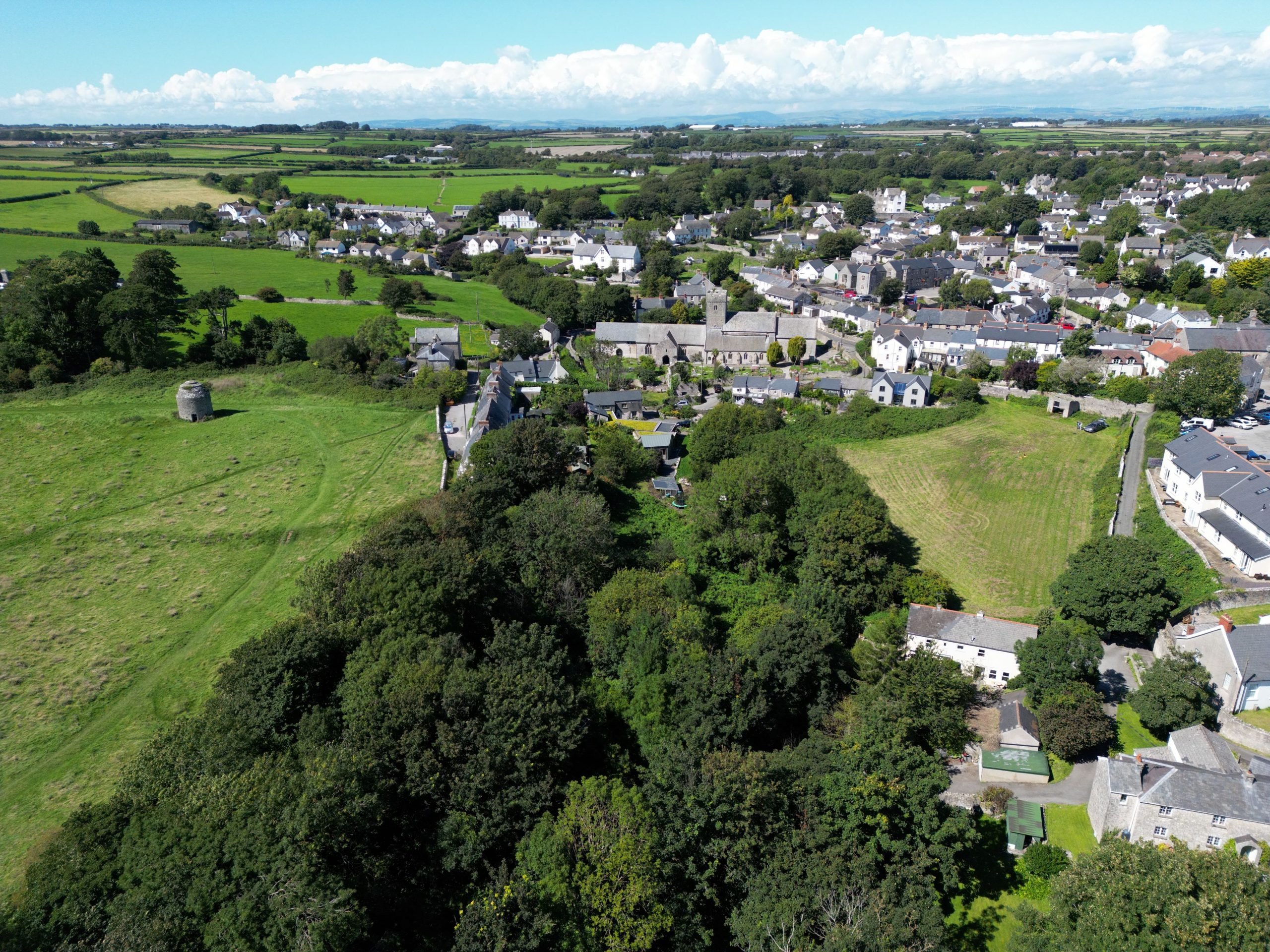
9/6/26: yesterday and today followed a similar pattern, with rainstorms in the early morning and then a more-or-less dry rest of the day. On the 8th, the opportunity was taken for creating an orthophoto while waiting for the site to dry sufficiently for further work. The image shows the same strong colour contrast as was observed at ground level during the open day. This image will help guide the excavation of the features in the coming days.

Some interesting finds have been made in recent days – particularly a significant quantity of horn cores from both cattle and goats from the larger ditch in the south east many showing cut marks where the horn had been detached. A further child grave was found today, meaning we have added four this year – three close to the area of the main cluster.
6/6/26: the week continued wet and windy, slowing progress considerably. Today was the site open day – and the weather was no different, perhaps a little wetter if anything. Despite this, around 280 people came to site and were very engaged. Thank you, both to our visitors and to the volunteers who came to help.
Over the last few days, the surface exposing the remains of the metalworking area had faded from its newly-trowelled state, but exposure to the rain today made the colours of the different deposits really ‘pop’ – some small compensation for the weather!
3/6/26: this was another weather-impacted day. The morning was very wet – so keep at least some of the team working, we moved the shelters into the trench. The unused polytunnels were then set up to replace them for the break area and for the finds washing area. Later the rain stopped, but the wind increased – so first the covers had to be removed from the shelters in the trench, and then as the gusts got stronger, one of the polytunnels tried to take flight – so the covers had to come off the polytunnels too.

Despite these challenges, some useful work work was achieved. The second of the infant burials was cleaned, photographed and removed. Almost immediately, the burial of a slightly older child was located, also cutting through the smithy area – so work was then undertaken to clean that.
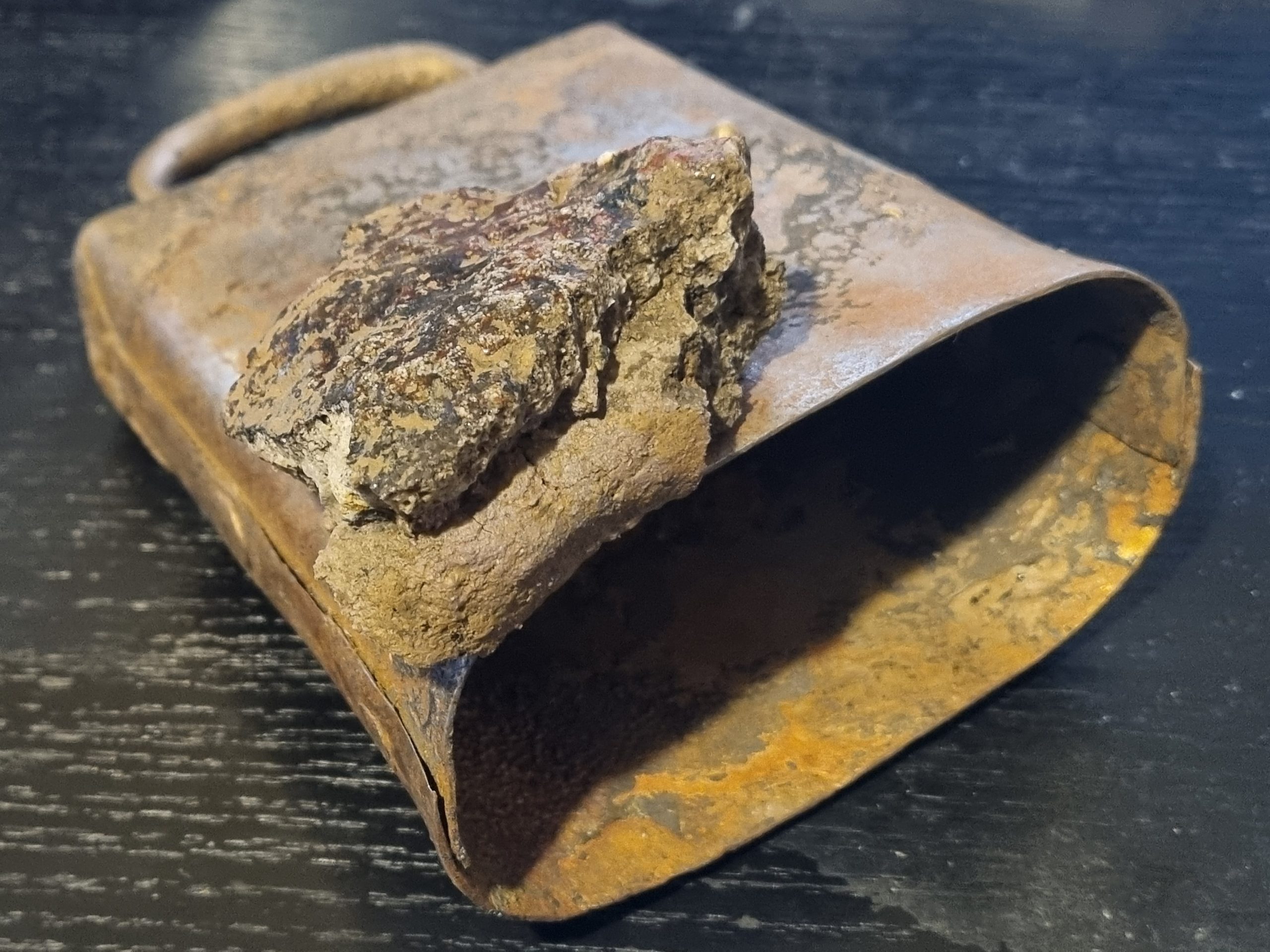
At the southeastern end of the trench, James made a a rather remarkable find – a rather unprepossessing fragmented piece of mineralised sheet iron, showing the characteristic green colouration from corrosion of copper alloy on its surface. The sheet iron was almost certainly brazed! We have previously found fragments of the ceramic coatings employed during the brazing process, but this was the first find of a potential product from that process. The most characteristic brazed object of the period are brazed iron handbells – could this be a failed brazing operation? The piece came from very close to the failed casting found a few days ago.

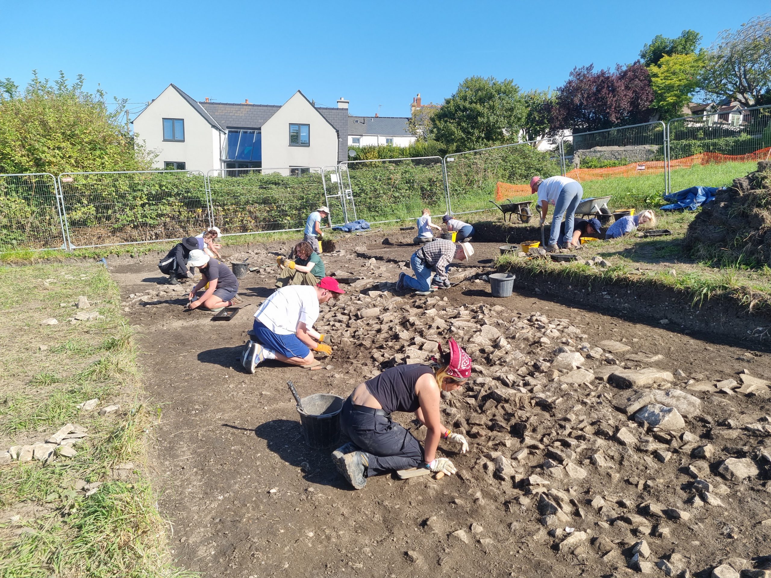
2/6/26: The threatened rain didn’t really materialise – and so it was a very busy and productive day on site, with the largest team yet (44). Great progress was made in all areas, particularly in the east, with almost the whole length within the ‘smithy’ area now down to features. In the west, the curious walls are now almost completely exposed and a great start has been made in removing the last of the backfill in the centre.

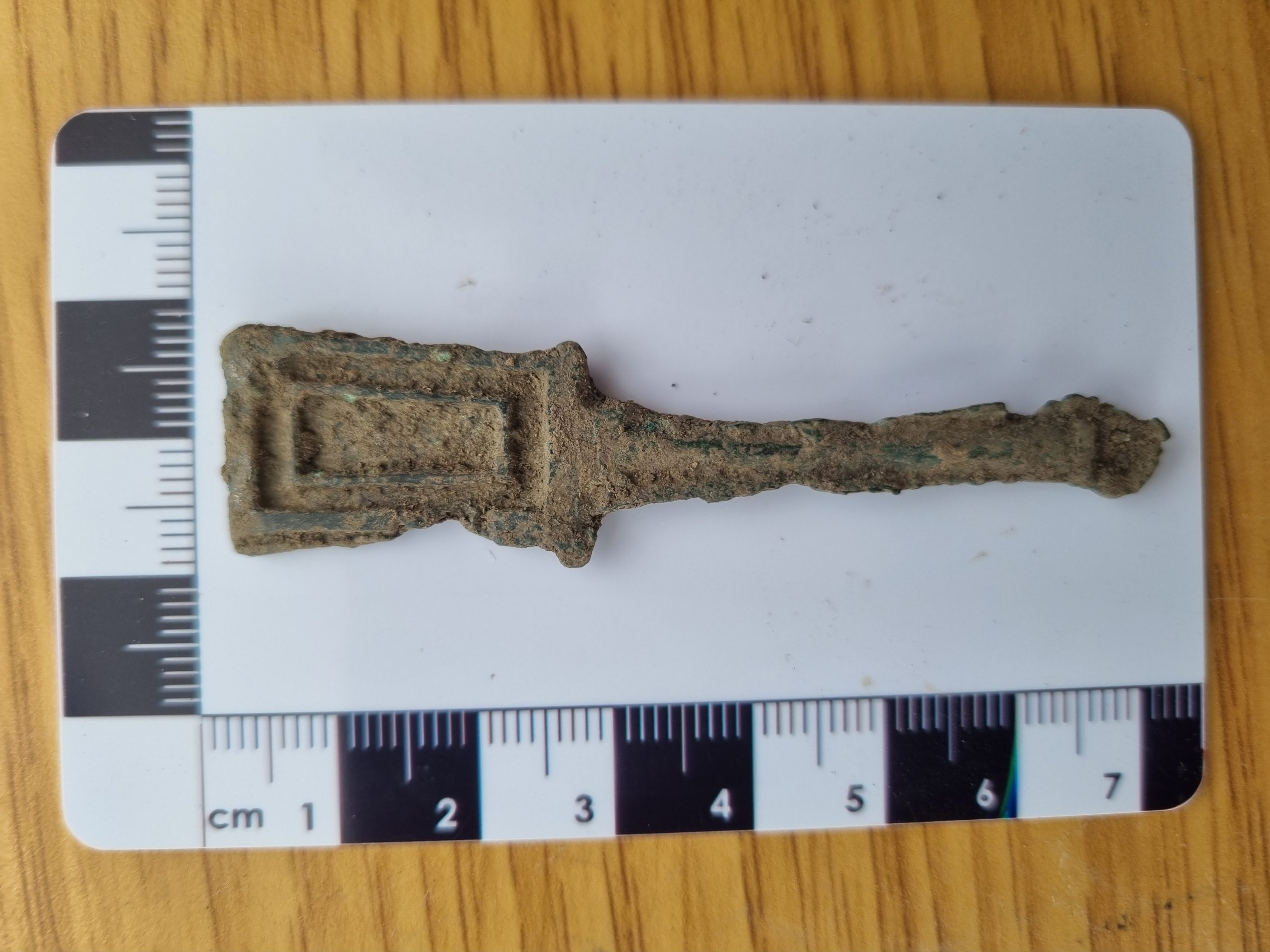
1/6/26: the start of our third week on site saw a change in the weather, becoming progressively wetter. Before the worst of it set in, the morning saw some good progress in all areas of the trench. There were several small finds, the most interesting of which was a failed casting of an object with a shaft and a flat head, apparently prepared for champlevé decoration. The reverse is plain. The current interpretation is that it may have been an æstel – a pointer used when reading from a manuscript. This was recovered in the SE part of the trench, where several contexts have proved rich in debris from copper-alloy working – including crucible sherds, copper-alloy spills and another small single-sided casting found last year (see the 2025 blog for 13/6/25).
By the afternoon, the weather deteriorated and the only real progress was made in the ‘smithy’ area, where further features were revealed including another infant burial , at a location about 6m NE of the main child cemetery.
29/5/26: at the end of the 2nd week of the project, the excavation feels on schedule. In the west, Trench 6 now exposes the cow thorax (no head, no limbs, no pelvis…) in the early pit. To the northeast, the area uncovered of the smithy slowly increases (with multiple gullies, hearths and postholes) and in the SE, the ridge of bedrock between the two large cut features has now been tidied.
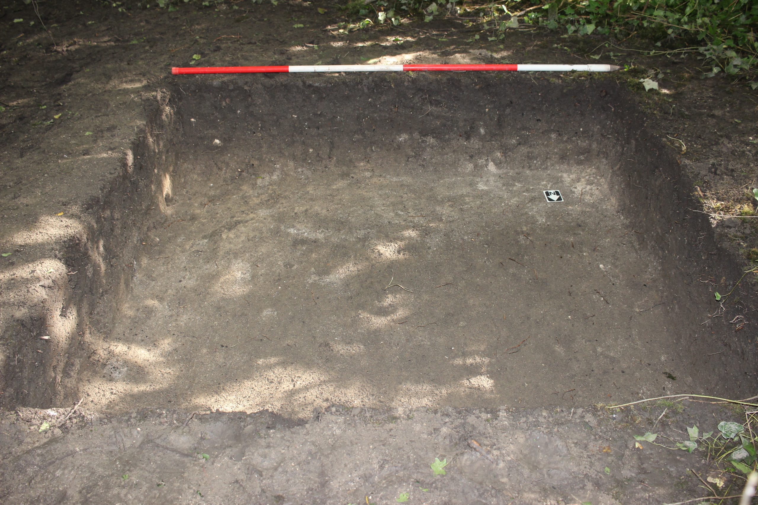
28/5/26: another very productive day’s work – particularly in the efforts of a large group to reduce the medieval cultivation soils along the NE side of the trench. By the end of the day the group had produced an exemplary neat section showing the layers accumulated since the early medieval.

To the west, it now seems clear that the large pit containing the cow (dated to cal. AD 650-780) cuts the gully/slot. Burnt wheat from this gully/slot is dated to cal. AD 550-650. The newly-determined stratigraphic relationship builds confidence that the gully/slot is indeed one of the earliest features recognised so far.
27/5/26: Today saw great progress right across the site. Not only was there a pleasant breeze, but we had the largest number of people on site so far this season – 38.

In the west of the site, the cow skeleton started to appear in its pit and, just to east the mysterious medieval structure was further revealed (though we still don’t know what it is!)

In the NE of the trench, structures probably associated with the 7th century smithy are becoming clearer, while the deep feature in the SE may now have a eastern margin.

26/5/26: Also Wales’ hottest day in May since records began! To counter the weather, the shelters were moved out onto site today – improving working conditions markedly.

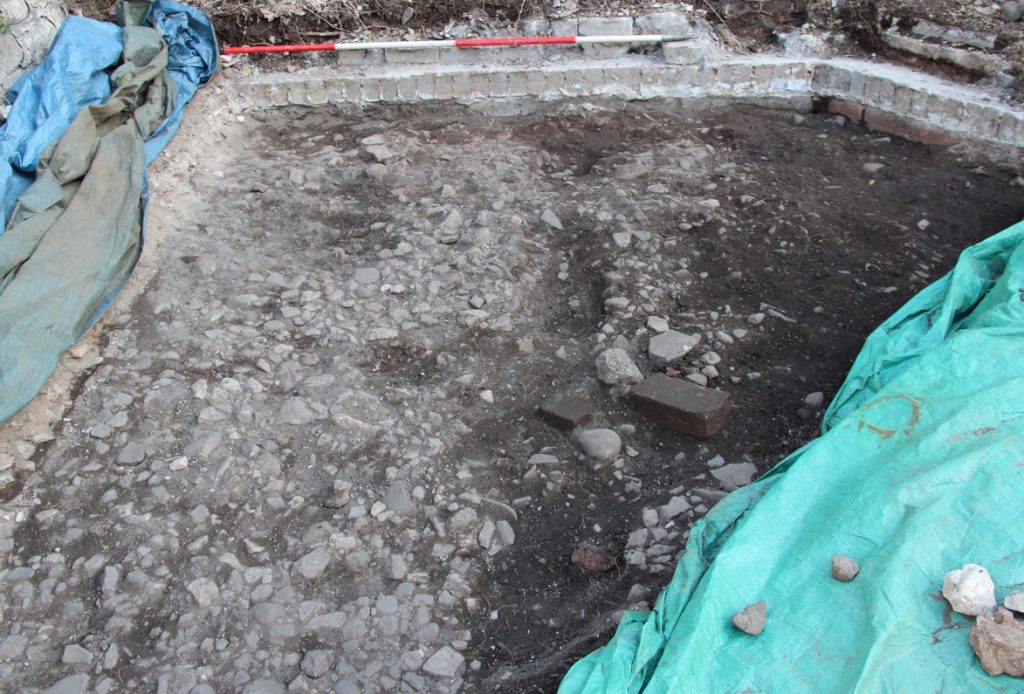
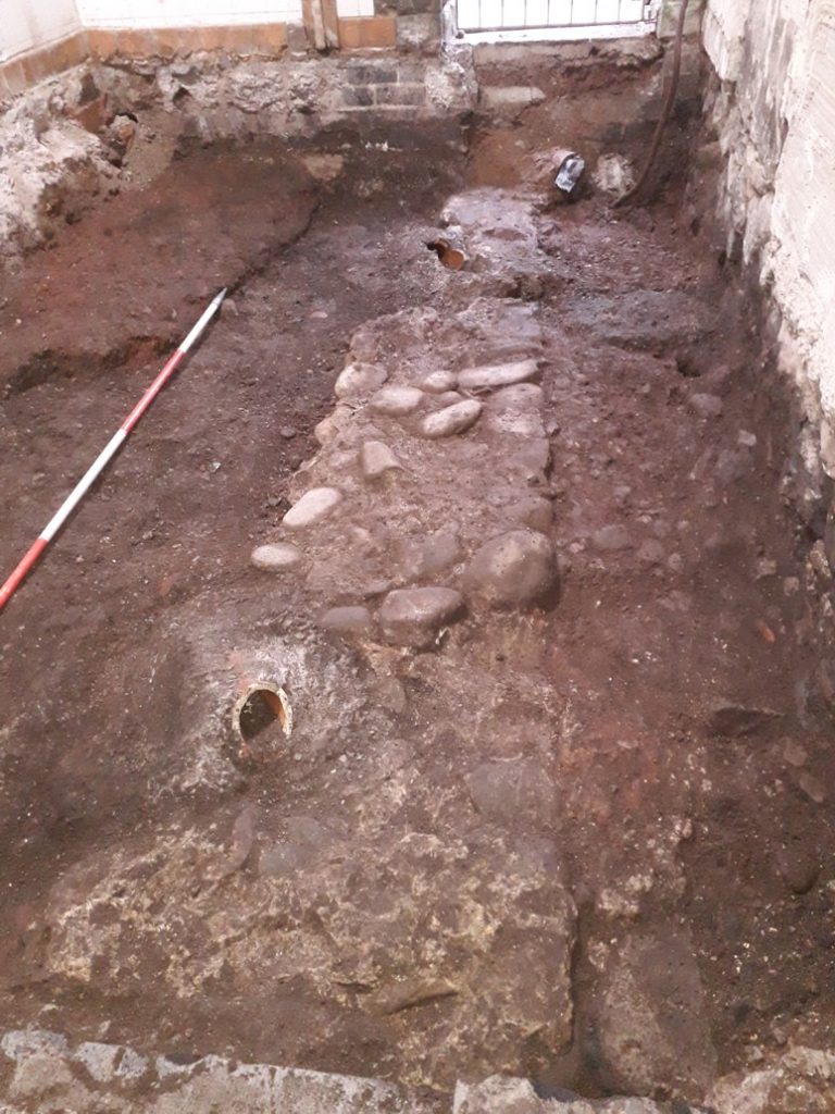
All groups made great progress today. Two areas in the east of Trench 4 had the Terram membrane finally removed, so that the early medieval deposits below are now being investigated. The western part of Trench 4 produced a large unexpected feature – a cut associated with some probable walling, with a dark, charcoal-rich containing large limestone blocks – possibly a floor. This feature appears likely to be associated with a medieval gully (also with a burnt fill) excavated last year. Trench 6 has now been excavated to natural, revealing the extent of the ‘cow pit’. This may possibly be two separate features – an eastern component with the cow and a western, with a darker fill and the large stones. We can also be reasonably certain that the expected gully does continue to the north of the ‘cow pit’. we can start excavating the features tomorrow to try to understand their order of cutting.
25/5/26: Wales’ hottest day in May since records began – so keeping the moisture in the ground was paramount – everything not actually being worked on needed to kept under covers. Good progress was made across the site despite the weather. Large sections of the site should appear from under the geotextile membrane tomorrow – which is forecast to be hotter than today…

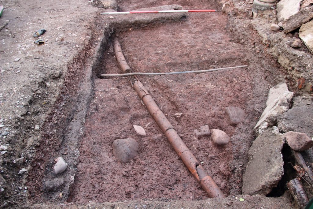
22/5/26: Already the end of Week 1! The later post-medieval issues in both the extensions to Trench 4 are now resolved and work on removing the underlying cultivation soils is proceeding apace. Both extensions will be working on medieval deposits on Monday. In the south end of Trench 4 has also progressed remarkably well and the Terram should be out of this area on Tuesday. In Trench 6, cleaning of the early medieval levels is in progress and the outline of the stone-filled pit is now visible. The project is definitely on-schedule – but next week will face different challenges thanks to the forecast heatwave.
Members of the team have also now created an Instagram account for the fieldwork – #globefieldarchaeology ! https://www.instagram.com/globefieldarchaeology/

21/5/26: A marked change in the weather – and a hot day. Progress in emptying the deeper parts of last year’s backfill was remarkably rapid! The remaining backfill was removed from the small trench (Trench 6) where it overlapped the old trench – revealing the stone-filled pit that contained part of a cow skeleton (dated to cal. AD 650-780) where seen last year. The area of fresh excavation is almost to early medieval levels- and already shows further very large stone blocks.

20/5/26: A rather damper day than forecast, but still a productive one. Although the main trench is slightly larger than last year’s, the slightly larger team means that progress feels rapid. Progress down towards the early medieval was impeded slightly by a few complications of 20th century date in two separate areas – both of which produced George V pennies (1916/1917) within a couple of minutes of each other.
19/5/26: Despite the rather damp weather at times, the season has got off to a good start. Yesterday was spent mainly setting-up, erecting the various tents, shelters and fences – and in induction sessions for the students. With the student group augmented by a large group of new volunteers, today saw the trench transformed from its rough machined state into a proper trench, with the first indications of archaeological features.
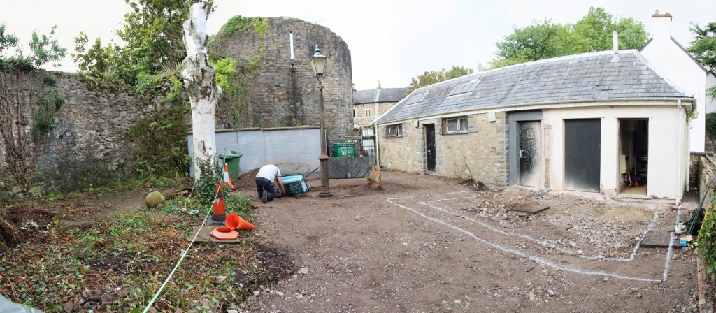
13/5/26: The 2026 season is finally almost here. The trenches were opened today – Trench 4 similar to last year, but with two extensions and the small Trench 5 targeting the early medieval pit with a partial cow skeleton in its top. The team assembles on Monday, but for new volunteers I would advise starting on Tuesday (weather-permitting) as Monday will largely involve the logistical tasks of erecting tents, shelters and fencing, as well as introducing the students to the site.
19/2/26: Although I posted the ‘stratigraphic narrative’ for the 2025 season last week, that contains a lot of detail, but no overall interpretation – so, I am going to follow it up with a discussion of current thinking. It is a rather longer blog post than usual, but hopefully sets up the background for the next season – now less than 3 months away.
Last season we finished with a complex of pits, postholes and gullies in the western part of the site, 3 inhumation burials outside the infant cemetery (2 adults in the east of the site and another infant slightly separate from the main group), a very productive gully in the ‘smithy’ area, a probable medieval latrine – and of course the well, down in trench 5 in the south of the field.
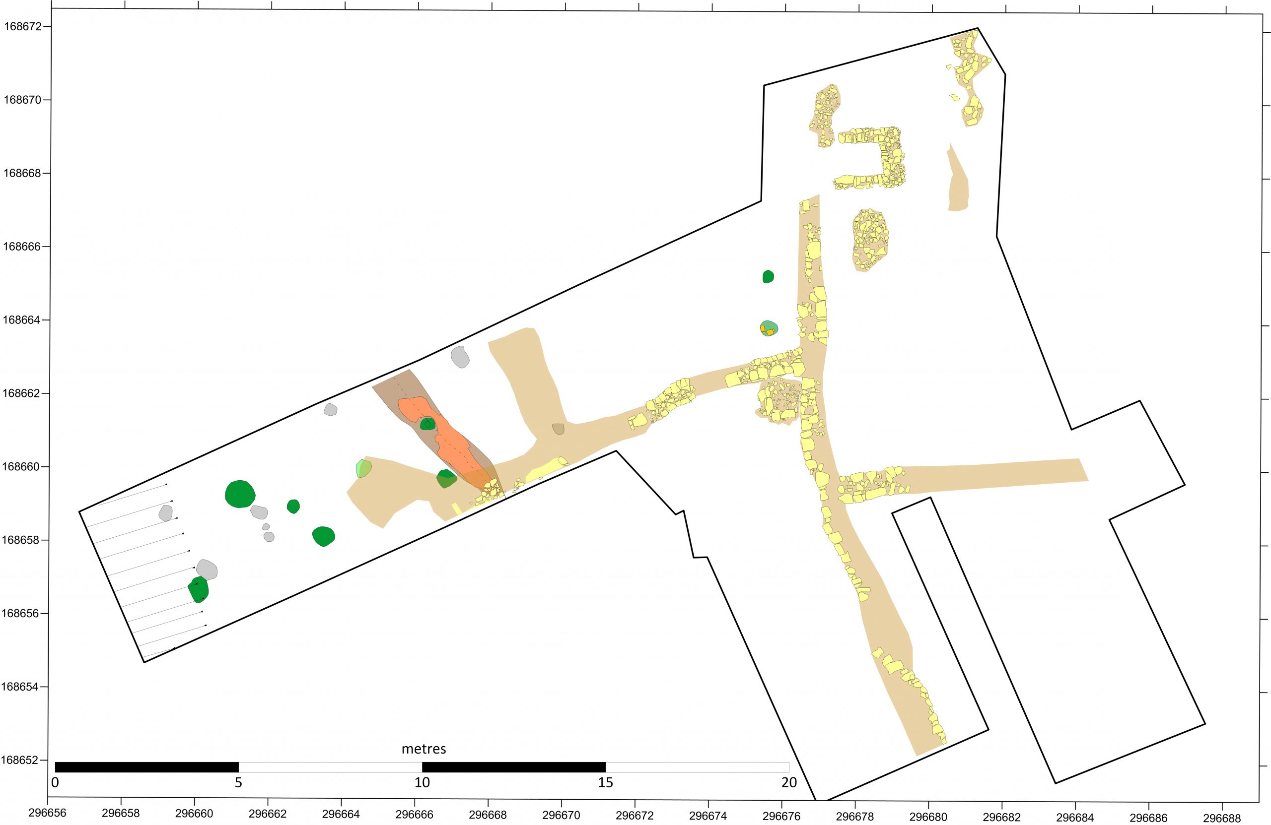
The well and some of the features in the west of the trench produced medieval pottery – mainly from the later 13th and 14th centuries. The area around the well is tentatively interpreted to have undergone two phases of quarrying – one perhaps in the 12th century and a second phase in the 14th. The medieval features in the west of the main trench are perhaps suggestive of features associated with the end of plots facing onto Burial Lane to the north. A small square building in the northeast of the site was probably a barrel latrine of 12th to 13th century age. To the west, some of the medieval pits appeared regularly spaced to the north of the stone wall. They didn’t appear to be postholes and so may perhaps be planting pits for fruit trees or something like that. There was also an enigmatic gully with a burnt fill, not quite at right angles to the stone wall, that might possibly be a boundary between different plots. Further work in this area in 2026 should help to clarify the geometry and relationships of these features.
We have also acquired 12 new radiocarbon dates this winter. These were targeted at understanding the burials and the cut-features that were without pottery evidence for a medieval age – and therefore potentially early medieval. Samples from these features were processed to find suitable material for dating – and they produced small assemblages of both charcoal and burnt wheat. The two large postholes with stone packing gave rather long-ranging late 7th century to early 9th dates on the charcoal, but 15th century dates on burnt wheat. In this area, the medieval cultivation soil was very thin and it is likely that the wheat grains are intrusive from above. The earlier dates on Prunus charcoal are tentatively accepted for the features.
Rather larger assemblages of wheat grains were obtained from a series of shallow gullies or furrows. This wheat (in three samples) produced rather earlier ages of mid-6th to mid-7th century age. Burnt wheat at this period suggests an association with the corn drier(s) that we think underlie the infant cemetery – but whether that wheat was residual when it entered the gullies, or whether it genuinely dates them is a moot point. This is another thing that will be receiving close attention in the coming season. These is also a question about the gullies themselves – are they agricultural features, as we thought during their excavation, or might they be structural – and be slots for timber sill beams?
Another curious feature in the western part of the trench was, frustratingly, right on the edge of the trench. This appear to be the margin of a large pit, containing large stones (resembling the medieval soakaways perhaps…). On top of the stones was part of the spine and ribs of a cow – and this, much to my surprise, gave a good late 7th to mid-8th century date. Since the remains were articulated, this provides a much more reliable date than those from the gullies and postholes in the same area. This feature, too, is going to have to be revisited in the next season, in order to understand both what it is and its physical relationships to the gullies.
The dates from the burials also gave a fee surprises. The burial on the east edge of the site (first located at the end of the 2024 season and fully excavated in 2025) gave a remarkably early date of AD600-680 – in other words potentially broadly contemporary with the cereal driers or the early part of the metalworking. It becomes, probably, the earliest burial known from the whole site. The metalworking features now have two dates, ranging from mid-7th to later 8th century. Modelling of the dates suggests it is possible that all the metalworking was within the late 7th century, but this remains very susceptible to the model. The second burial on the east side (an extremely short young man with curiously worn teeth) gave a date with a rather long possible range from late 7th to 9th centuries, so not so easy slot into the overall site development. The third burial, a young child just slightly separate from the main infant cemetery, gave a date of late 7th into the 8th century – suggesting it may have been earlier than the main infant cemetery just to its west.
Thus, the early medieval development of the site is revealed to much more complex than we had previously understood. The early activity in the west remains associated with the cereal drier – but might now include a structural element too. The metalworking appears to start early, possibly from the middle of the 7th century – and one of the inhumations now dates to this phase as well (with the grave even having crucible fragments in tis fill). By the 8th century there is more convincing structural evidence in the west, with the smithy to its east possibly now out of use, and late in the 8th century the infant cemetery developed. It is clear that the small area we are investigating was very ‘busy’ throughout a period from the latest 6th to mid-9th centuries!
11/2/26: the post-excavation tasks from the 2025 season that were scheduled for this winter are now essentially complete. The stratigraphic narrative for the 2025 season is now available via the Resources page.
Plans for the 2026 season are now well advanced – and it will run from 18th May until 12th June. The Research Design for the 2026 season is also now available on the Resources page.